MyTopo
Oxbo Wisconsin US Topo Map
Couldn't load pickup availability
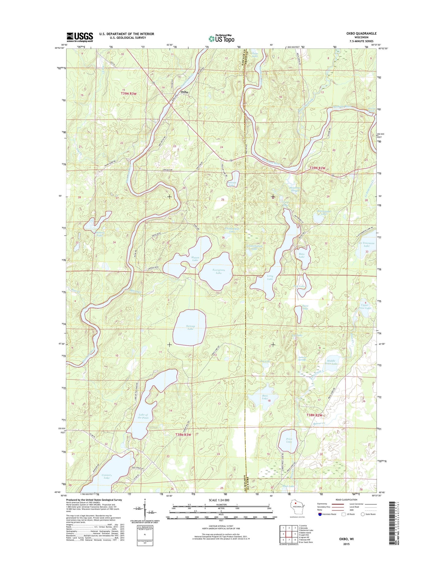
2022 topographic map quadrangle Oxbo in the state of Wisconsin. Scale: 1:24000. Based on the newly updated USGS 7.5' US Topo map series, this map is in the following counties: Sawyer, Price. The map contains contour data, water features, and other items you are used to seeing on USGS maps, but also has updated roads and other features. This is the next generation of topographic maps. Printed on high-quality waterproof paper with UV fade-resistant inks.
Quads adjacent to this one:
West: Babbs Island
Northwest: Loretta
North: Kennedy
Northeast: Butternut Lake
East: Lugerville
Southeast: Lac Sault Dore
South: Kennan NW
Southwest: Ingram NE
This map covers the same area as the classic USGS quad with code o45090g6.
Contains the following named places: Barnaby Rapids, Bass Lake, Bear Creek, Beaver Creek, Berends Quarry, Butternut Creek, Carp Lake, Cat Lake, Champagne Lake, Connors Lake, Connors Lake Lookout Tower, Constellation Lake, Dave Lake, Deadman Slough, Dog Lake, Evergreen Lake, Hanson Lake, Homestead Lake, Jackson Springs, Lake of the Pines, Lake of the Pines Conifer-Hardwoods State Natural Area, Le Tourneau Lake, Log Creek, Long Lake, Mason Creek, Mason Lake, Middle Price Lake, Mud Lake, Oxbo, Oxbo Lake, Pelican Lake, Pot Lake, Price Lake, Swamp Lake, Upper Price Lake