MyTopo
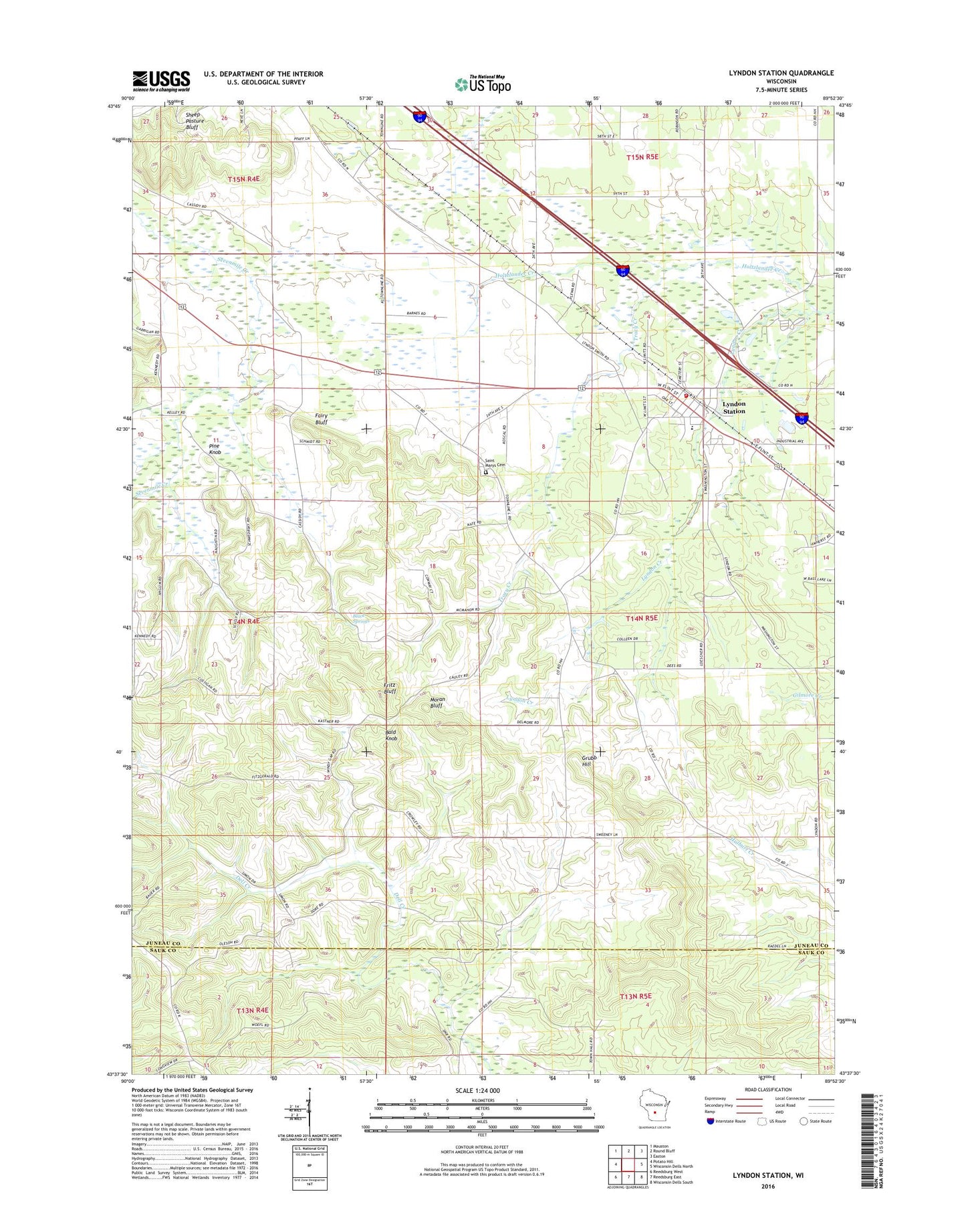
Lyndon Station Wisconsin US Topo Map
Couldn't load pickup availability
2022 topographic map quadrangle Lyndon Station in the state of Wisconsin. Scale: 1:24000. Based on the newly updated USGS 7.5' US Topo map series, this map is in the following counties: Juneau, Sauk. The map contains contour data, water features, and other items you are used to seeing on USGS maps, but also has updated roads and other features. This is the next generation of topographic maps. Printed on high-quality waterproof paper with UV fade-resistant inks.
Quads adjacent to this one:
West: Potato Hill
Northwest: Mauston
North: Round Bluff
Northeast: Easton
East: Wisconsin Dells North
Southeast: Wisconsin Dells South
South: Reedsburg East
Southwest: Reedsburg West
This map covers the same area as the classic USGS quad with code o43089f8.
Contains the following named places: Bald Knob, Black Springs, Fairy Bluff, Fritz Bluff, Grubb Hill, Holtzlander Creek, Lyndon Station, Lyndon Station Elementary School, Lyndon Station Fire and Rescue, Lyndon Station Police Department, Lyndon Station Post Office, Moran Bluff, Pine Knob, Round Bluff Station, Saint Marys Cemetery, Sheep Pasture Bluff, Town of Kildare, Tracy Creek, Village of Lyndon Station, ZIP Code: 53944