MyTopo
Markesan Wisconsin US Topo Map
Couldn't load pickup availability
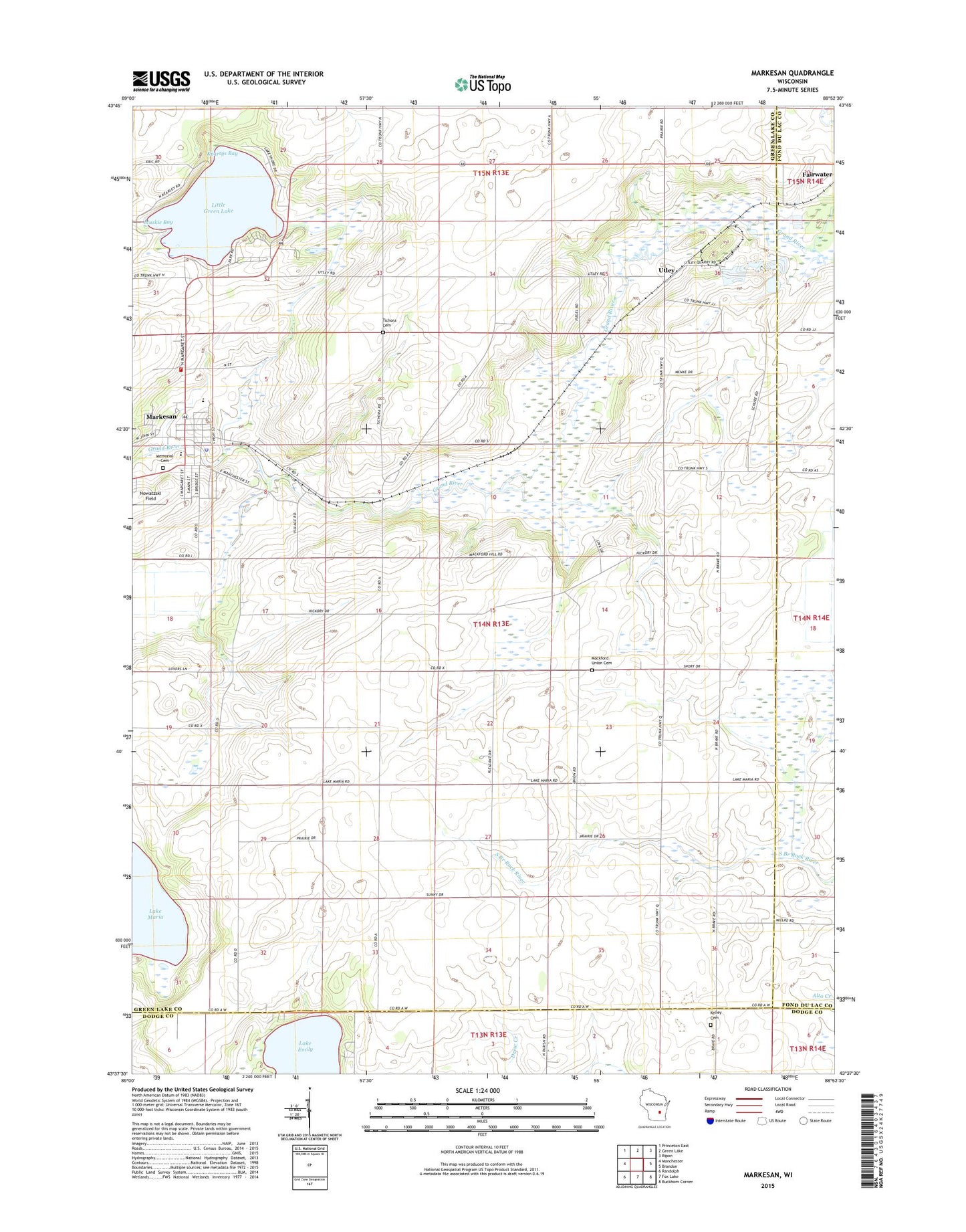
2018 topographic map quadrangle Markesan in the state of Wisconsin. Scale: 1:24000. Based on the newly updated USGS 7.5' US Topo map series, this map is in the following counties: Green Lake, Fond du Lac, Dodge. The map contains contour data, water features, and other items you are used to seeing on USGS maps, but also has updated roads and other features. This is the next generation of topographic maps. Printed on high-quality waterproof paper with UV fade-resistant inks.
Quads adjacent to this one:
West: Manchester
Northwest: Princeton East
North: Green Lake
Northeast: Ripon
East: Brandon
Southeast: Buckhorn Corner
South: Fox Lake
Southwest: Randolph
Contains the following named places: Bosveld Brothers Landing Strip, Broeder Quarry, City of Markesan, County Line Church, Del Monte Corporation Landing Strip, Evergreen School, Grand Prairie Cemetery, Grand River Fire District - Markesan Fire Department, Keartys Bay, Lake Emily, Lake Emily School, Little Green Lake, Lonely Cedar School, Mackford Prairie School, Mackford Union Cemetery, Markesan, Markesan City Government Fire Department, Markesan Elementary School, Markesan High - Middle School, Markesan Middle / High School, Markesan Police Department, Markesan Post Office, Markesan Primary School, Markesan Wastewater Treatment Facility, Memorial Cemetery, Muskie Bay, North Mackford School, Prairie View School, Rogers Memorial State Habitat Preserve, Saint Johns Lutheran Church, Soldiers-Sailors Park, Southern Green Lake County Ambulance Service, Sunny Hillside School, Tichora Cemetery, Town of Mackford, Utley