MyTopo
Manchester Wisconsin US Topo Map
Couldn't load pickup availability
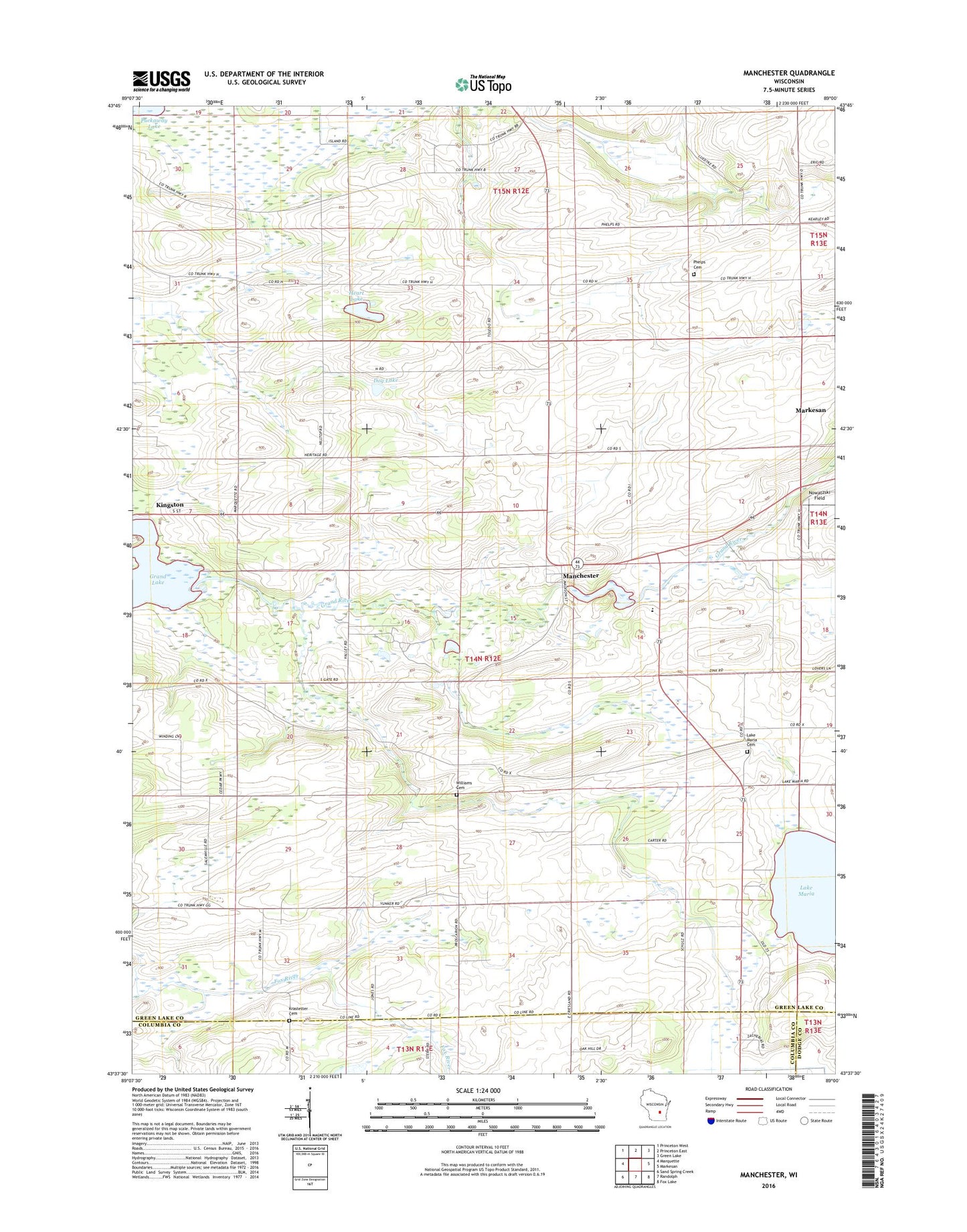
2022 topographic map quadrangle Manchester in the state of Wisconsin. Scale: 1:24000. Based on the newly updated USGS 7.5' US Topo map series, this map is in the following counties: Green Lake, Columbia, Dodge. The map contains contour data, water features, and other items you are used to seeing on USGS maps, but also has updated roads and other features. This is the next generation of topographic maps. Printed on high-quality waterproof paper with UV fade-resistant inks.
Quads adjacent to this one:
West: Marquette
Northwest: Princeton West
North: Princeton East
Northeast: Green Lake
East: Markesan
Southeast: Fox Lake
South: Randolph
Southwest: Sand Spring Creek
This map covers the same area as the classic USGS quad with code o43089f1.
Contains the following named places: Carter School, Dantz Tavern School, Dog Lake, Faith Church, Faith Lutheran School, Grand Lake, Heart Lake, Hilltop Landing Strip, Krastetter Cemetery, Lake Maria, Lake Maria Cemetery, Manchester, Manchester Dam, Manchester Millpond 72, Military Road School, Mill Pond, Nowatzski Field, Oak Grove School, Phelps Cemetery, Saint Johns Church, Salemville School, Town of Manchester, West Manchester School, Williams Cemetery, ZIP Code: 53946