MyTopo
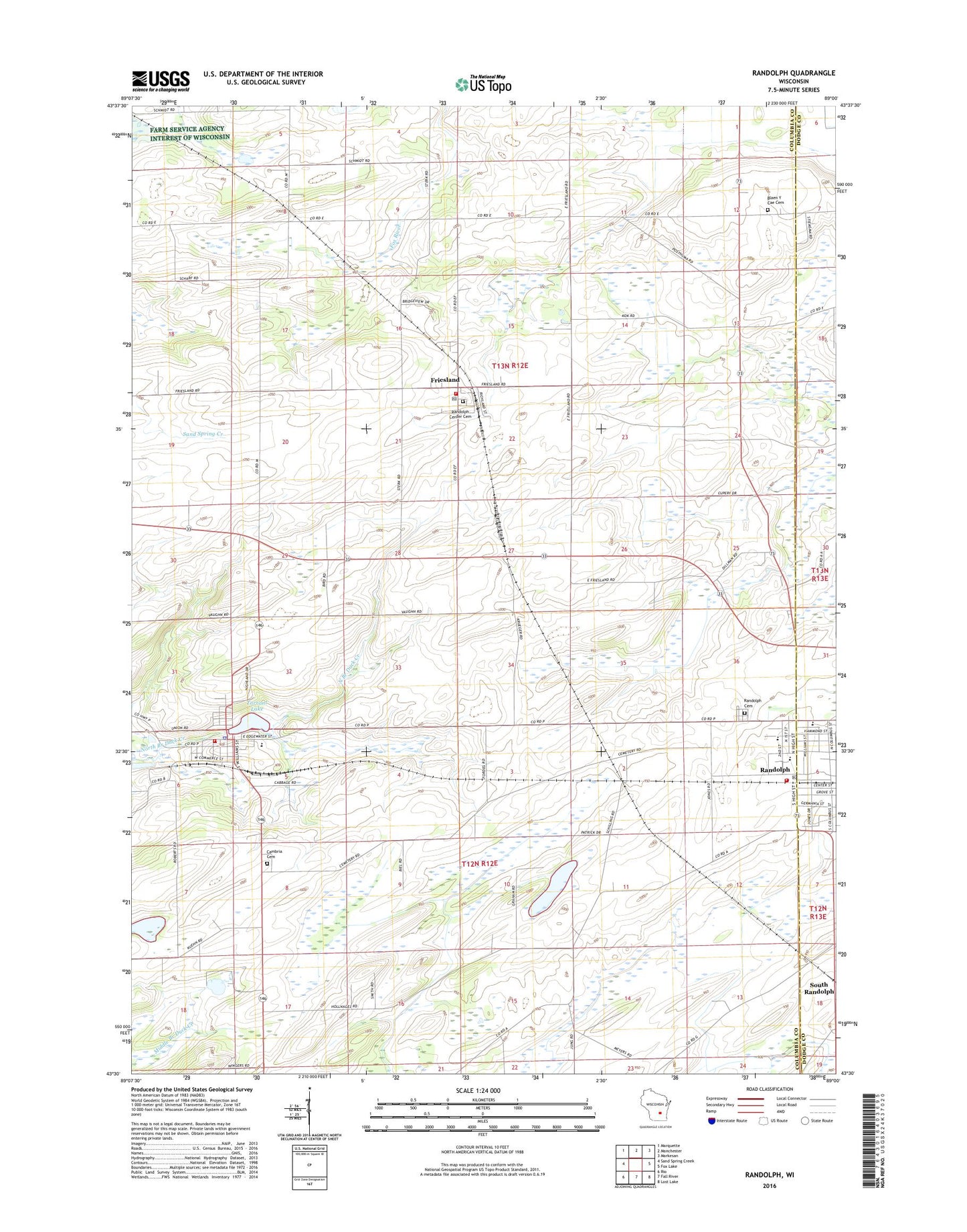
Randolph Wisconsin US Topo Map
Couldn't load pickup availability
2022 topographic map quadrangle Randolph in the state of Wisconsin. Scale: 1:24000. Based on the newly updated USGS 7.5' US Topo map series, this map is in the following counties: Columbia, Dodge. The map contains contour data, water features, and other items you are used to seeing on USGS maps, but also has updated roads and other features. This is the next generation of topographic maps. Printed on high-quality waterproof paper with UV fade-resistant inks.
Quads adjacent to this one:
West: Sand Spring Creek
Northwest: Marquette
North: Manchester
Northeast: Markesan
East: Fox Lake
Southeast: Lost Lake
South: Fall River
Southwest: Rio
This map covers the same area as the classic USGS quad with code o43089e1.
Contains the following named places: Alsum Farms, Bethany Presbyterian Church, Cambria, Cambria Cemetery, Cambria Community Fire Department, Cambria Friesland Elementary School, Cambria Friesland Middle / High School, Cambria Police Department, Cambria Post Office, Cambria WP53 Dam, Diamond S Dairy, East Friesland, Engedi Cemetery, Faith Christian School, First Methodist Church, First Presbyterian Church, First Reformed Church, Friedens Evangelical Lutheran Church, Friesland, Friesland Cemetery, Friesland Fire Department, Friesland Post Office, Hutchinson Memorial Library, Penrhos School, Randolph, Randolph Cemetery, Randolph Christian School, Randolph Church, Randolph Elementary / Middle School, Randolph Fire Department, Randolph Police Department, Randolph Post Office, Randolph Protestant Reformed Church, Randolph Village Hall, Randolph Wastewater Treatment Facility, Retzlaff Farm, Second Christian Church, Stone School, Tarrant Lake, Town of Courtland, Town of Randolph, Village of Cambria, Village of Friesland, Village of Randolph, Zion Lutheran Church, ZIP Codes: 53935, 53956