MyTopo
Meehan Wisconsin US Topo Map
Couldn't load pickup availability
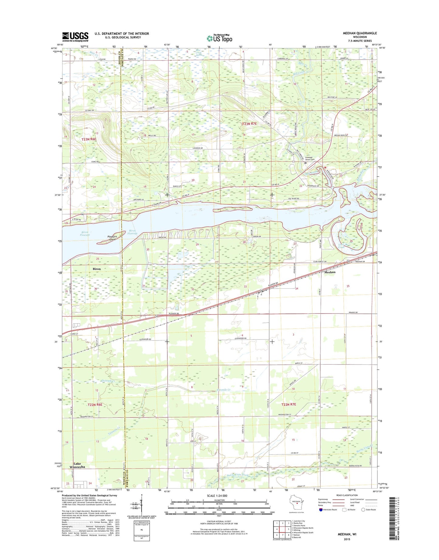
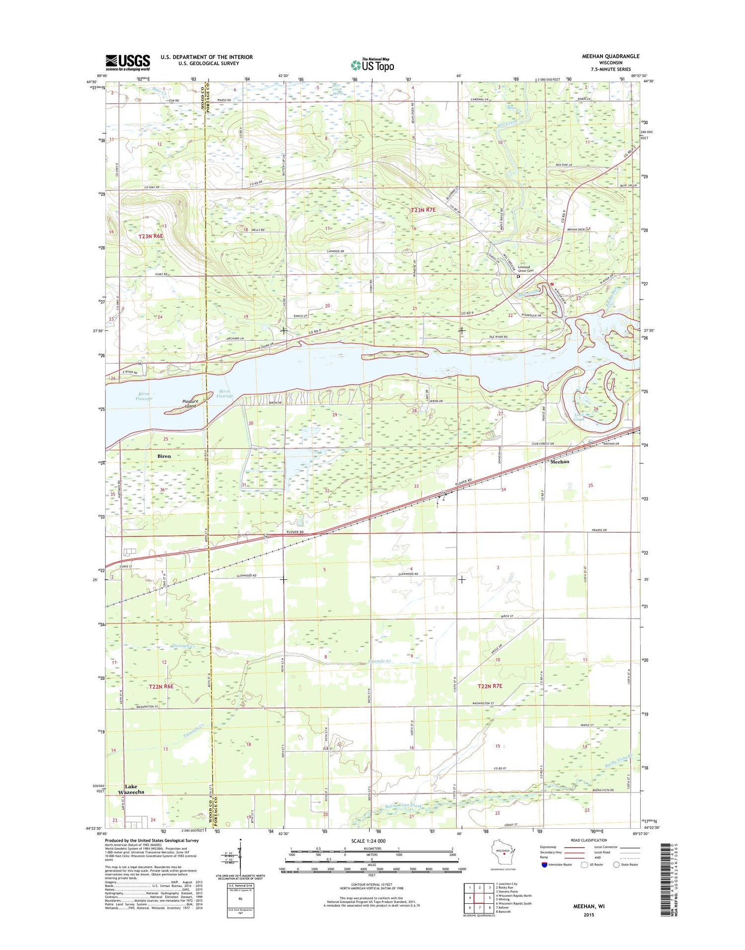
2018 topographic map quadrangle Meehan in the state of Wisconsin. Scale: 1:24000. Based on the newly updated USGS 7.5' US Topo map series, this map is in the following counties: Portage, Wood. The map contains contour data, water features, and other items you are used to seeing on USGS maps, but also has updated roads and other features. This is the next generation of topographic maps. Printed on high-quality waterproof paper with UV fade-resistant inks.
Quads adjacent to this one:
West: Wisconsin Rapids North
Northwest: Junction City
North: Rocky Run
Northeast: Stevens Point
East: Whiting
Southeast: Bancroft
South: Kellner
Southwest: Wisconsin Rapids South
Contains the following named places: Bear Creek, Biron Flowage, Hill View School, La Follette School, Linwood Union Cemetery, Love Creek, Meehan, Mill Creek, Pearl School, Pleasure Island, Restlawn Memorial Park, Rocky Run, Rudolph Volunteer Fire Department Station 2 - Linwood, Town of Linwood, WIZD-FM (Rudolph), Woodville School