MyTopo
Rocky Run Wisconsin US Topo Map
Couldn't load pickup availability
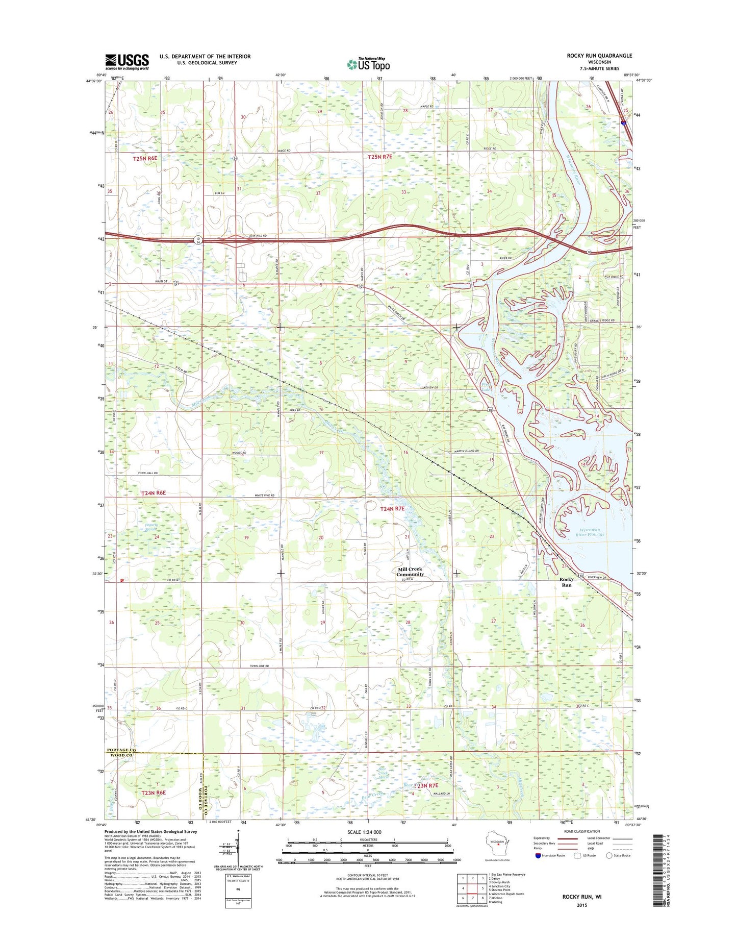
2022 topographic map quadrangle Rocky Run in the state of Wisconsin. Scale: 1:24000. Based on the newly updated USGS 7.5' US Topo map series, this map is in the following counties: Portage, Wood. The map contains contour data, water features, and other items you are used to seeing on USGS maps, but also has updated roads and other features. This is the next generation of topographic maps. Printed on high-quality waterproof paper with UV fade-resistant inks.
Quads adjacent to this one:
West: Junction City
Northwest: Big Eau Pleine Reservoir
North: Dancy
Northeast: Dewey Marsh
East: Stevens Point
Southeast: Whiting
South: Meehan
Southwest: Wisconsin Rapids North
This map covers the same area as the classic USGS quad with code o44089e6.
Contains the following named places: Bear Creek Marsh, Cary School, First Lake, Green Meadow School, Lake View School, Mallory School, Mill Creek Community, Oak Hill School, Rocky Run, Rocky Run School, Rudolph Volunteer Fire Department Station 4, Saint Bartholomew Church, Second Lake, Sims School, Town of Carson, WIGL-FM (Stevens Point), Wilson School, WYTE-FM (Whiting), ZIP Code: 54481