
MyTopo
Mineral Lake Wisconsin US Topo Map
Couldn't load pickup availability
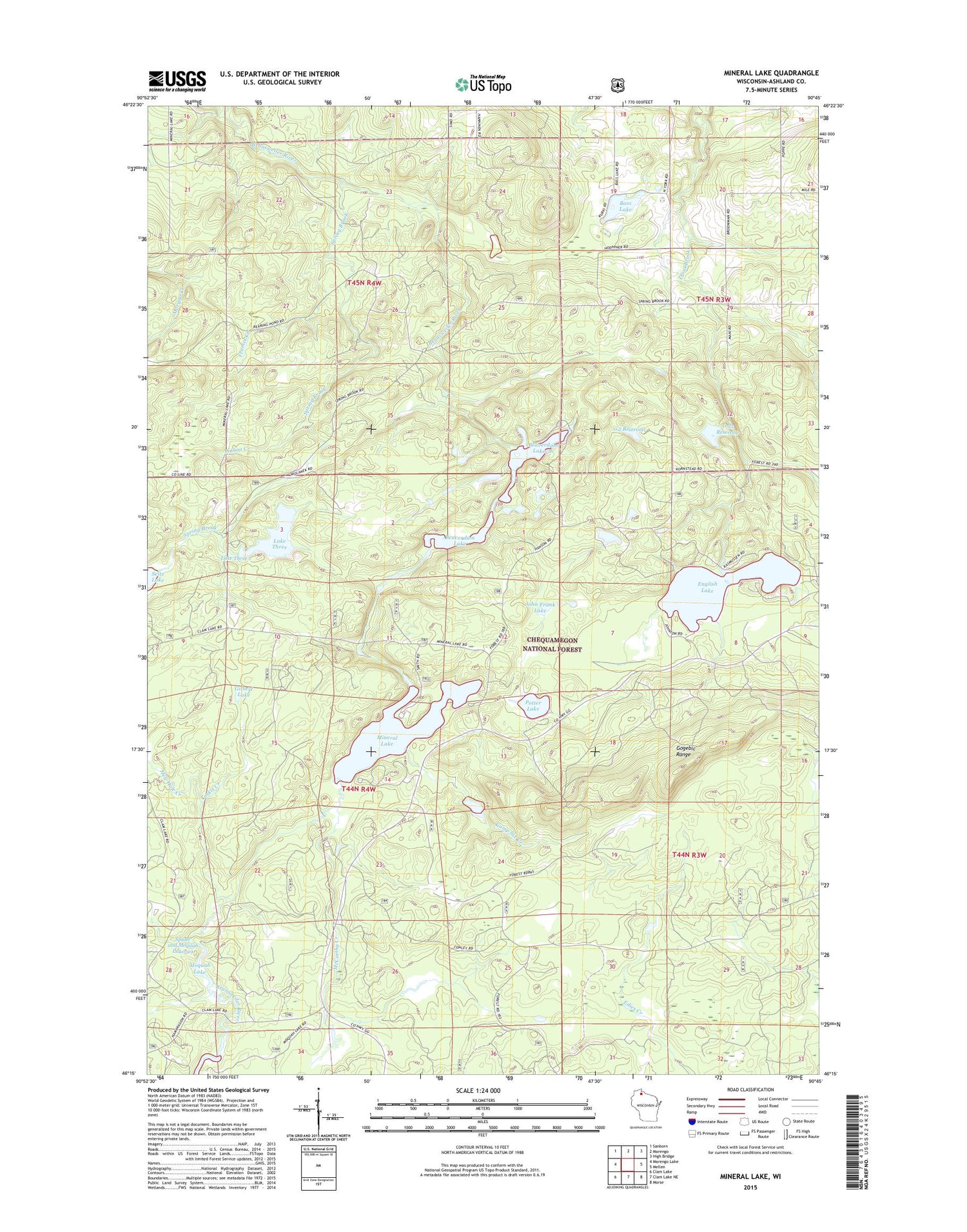
2018 topographic map quadrangle Mineral Lake in the state of Wisconsin. Scale: 1:24000. Based on the newly updated USGS 7.5' US Topo map series, this map is in the following counties: Ashland. The map contains contour data, water features, and other items you are used to seeing on USGS maps, but also has updated roads and other features. This is the next generation of topographic maps. Printed on high-quality waterproof paper with UV fade-resistant inks.
Quads adjacent to this one:
West: Marengo Lake
Northwest: Sanborn
North: Marengo
Northeast: High Bridge
East: Mellen
Southeast: Morse
South: Clam Lake NE
Southwest: Clam Lake
Contains the following named places: Bass Lake, Beaverdam Lake, Beaverdam Lake 36, Brunsweiler Creek Dam, Camp Six Creek, Chequamegon Hardwoods State Natural Area, English Lake, Frames Creek, Gilbert Lake, Hell Hole Creek, Hudson Bay 3WR232 Dam, John Frank Lake, Lake Three, Lake Three 1, Lake Three 2WP433 Dam, Lake Three Recreation Site, Marengo Lookout Tower, Martin Hanson Dam, McCarthy Creek, Mineral Lake, Mineral Lake Lookout Tower, Mineral Lake Recreation Site, Pine Stump Corner, Potter Lake, Potter Lake Recreation Site, Spider and Moquah Lakes 19, Spring Brook, Toskis Creek, Town of Marengo, Uihlein Dam, Waboo Creek


