MyTopo
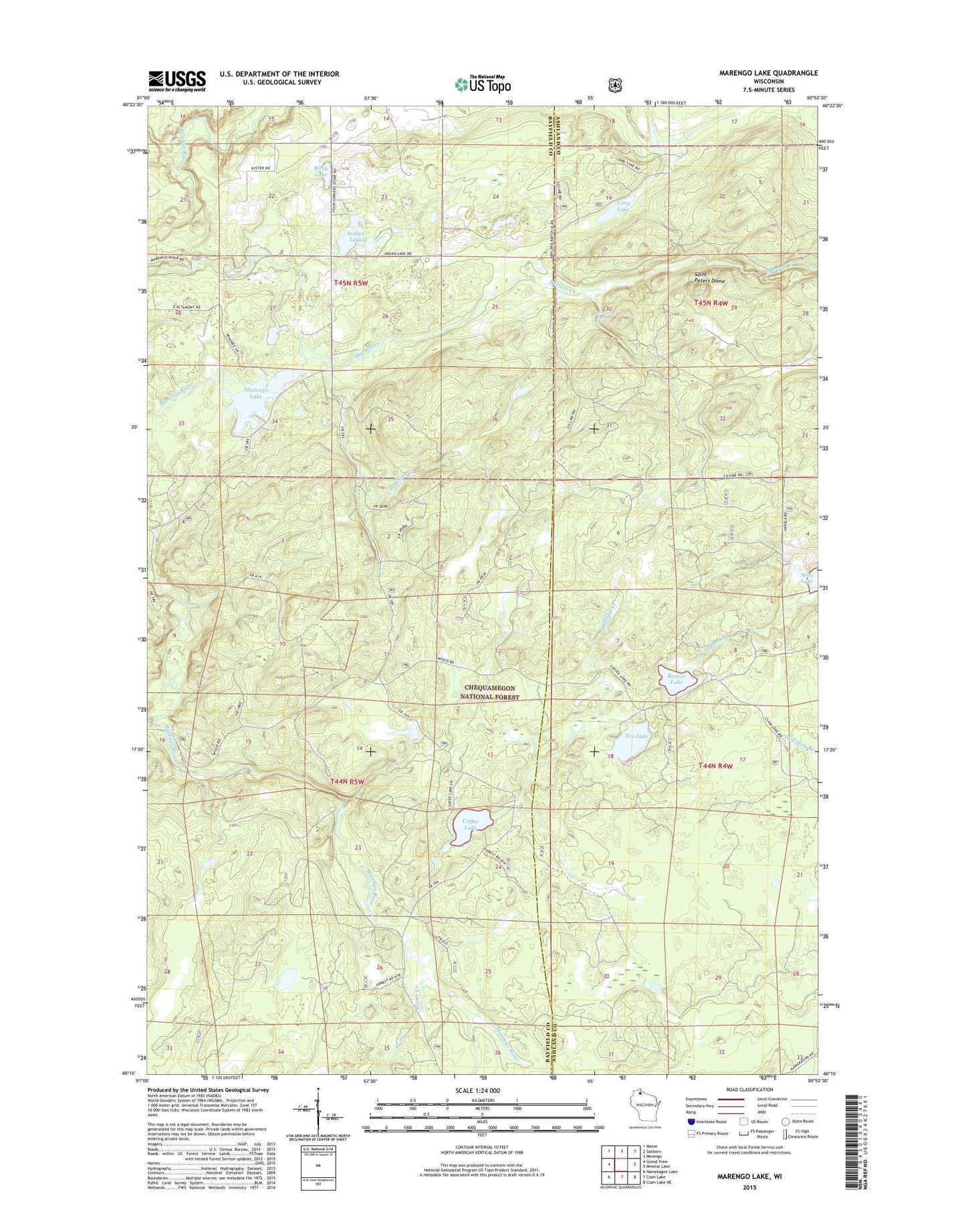
Marengo Lake Wisconsin US Topo Map
Couldn't load pickup availability
Also explore the Marengo Lake Forest Service Topo of this same quad for updated USFS data
2022 topographic map quadrangle Marengo Lake in the state of Wisconsin. Scale: 1:24000. Based on the newly updated USGS 7.5' US Topo map series, this map is in the following counties: Bayfield, Ashland. The map contains contour data, water features, and other items you are used to seeing on USGS maps, but also has updated roads and other features. This is the next generation of topographic maps. Printed on high-quality waterproof paper with UV fade-resistant inks.
Quads adjacent to this one:
West: Grand View
Northwest: Mason
North: Sanborn
Northeast: Marengo
East: Mineral Lake
Southeast: Clam Lake NE
South: Clam Lake
Southwest: Namekagon Lake
This map covers the same area as the classic USGS quad with code o46090c8.
Contains the following named places: Beaver Lake, Beaver Lake Recreation, Birch Lake, Blaser Creek, Coffee Lake, Hawkins Creek, Indian Lake, Long Lake, Marengo 2WP85 Dam, Marengo Lake, Marengo River, Mikinaak Lake, Morgan Creek, Morgan Falls, Morgan Falls and Saint Peters Dome Point of Interest, Mud Lake, Saint Peters Dome, Seitz Lake, Spring Brook, Spruce Lake, Tea Lake, Town of Lincoln, Trinity Church, Whisky Creek