MyTopo
Clam Lake Wisconsin US Topo Map
Couldn't load pickup availability
Also explore the Clam Lake Forest Service Topo of this same quad for updated USFS data
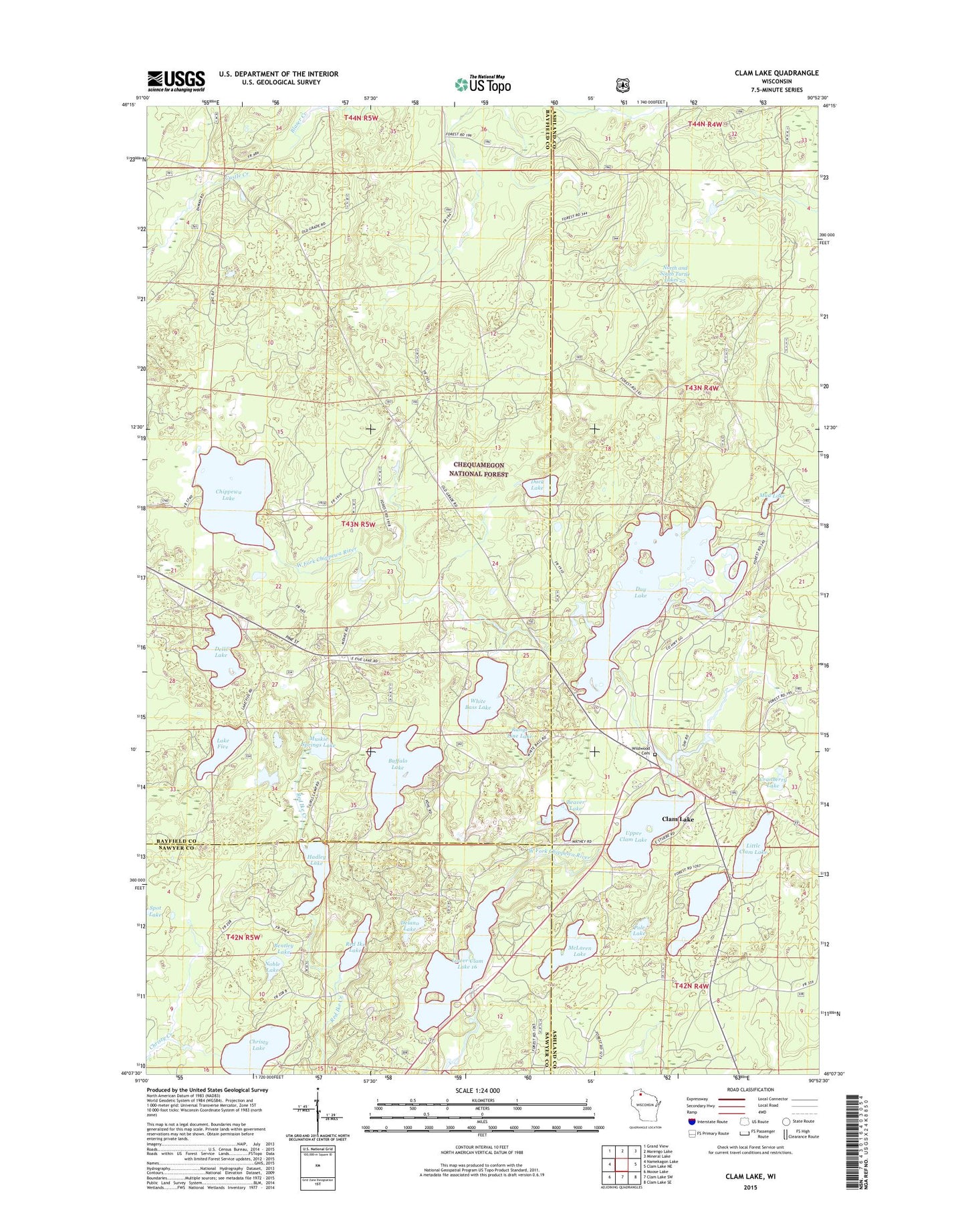
2022 topographic map quadrangle Clam Lake in the state of Wisconsin. Scale: 1:24000. Based on the newly updated USGS 7.5' US Topo map series, this map is in the following counties: Bayfield, Ashland, Sawyer. The map contains contour data, water features, and other items you are used to seeing on USGS maps, but also has updated roads and other features. This is the next generation of topographic maps. Printed on high-quality waterproof paper with UV fade-resistant inks.
Quads adjacent to this one:
West: Namekagon Lake
Northwest: Grand View
North: Marengo Lake
Northeast: Mineral Lake
East: Clam Lake NE
Southeast: Clam Lake SE
South: Clam Lake SW
Southwest: Moose Lake
This map covers the same area as the classic USGS quad with code o46090b8.
Contains the following named places: Beaver Lake, Bentley Lake, Buffalo Lake, Chippewa Lake, Christy Lake, Church of Saint George, Clam Lake, Clam Lake Cemetery, Clam Lake Census Designated Place, Clam Lake Field Station, Clam Lake Guard Station, Clam Lake Lookout Tower, Clam Lake Post Office, Cranberry Lake, Day Dam, Day Lake, Day Lake Campground, Delano Lake, Dells Lake, Duck Lake, Hadley Lake, Lake Five, Little Clam Lake, Little Clam Lake Seaplane Base, Lower Clam Lake, Lower Clam Lake 16, Lower Clam Lake Dam, McLaren Lake, Mud Lake, Muskie Springs Lake, Noble Lake, North and South Turtle Lakes 25, Pole Lake, Range Line Lake, Red Ike Lake, Spider Lake State Natural Area, Spot Lake, Turtle Lake 2WP845 Dam, Upper Clam Lake, White Bass Lake, ZIP Code: 54517