MyTopo
Moen Lake Wisconsin US Topo Map
Couldn't load pickup availability
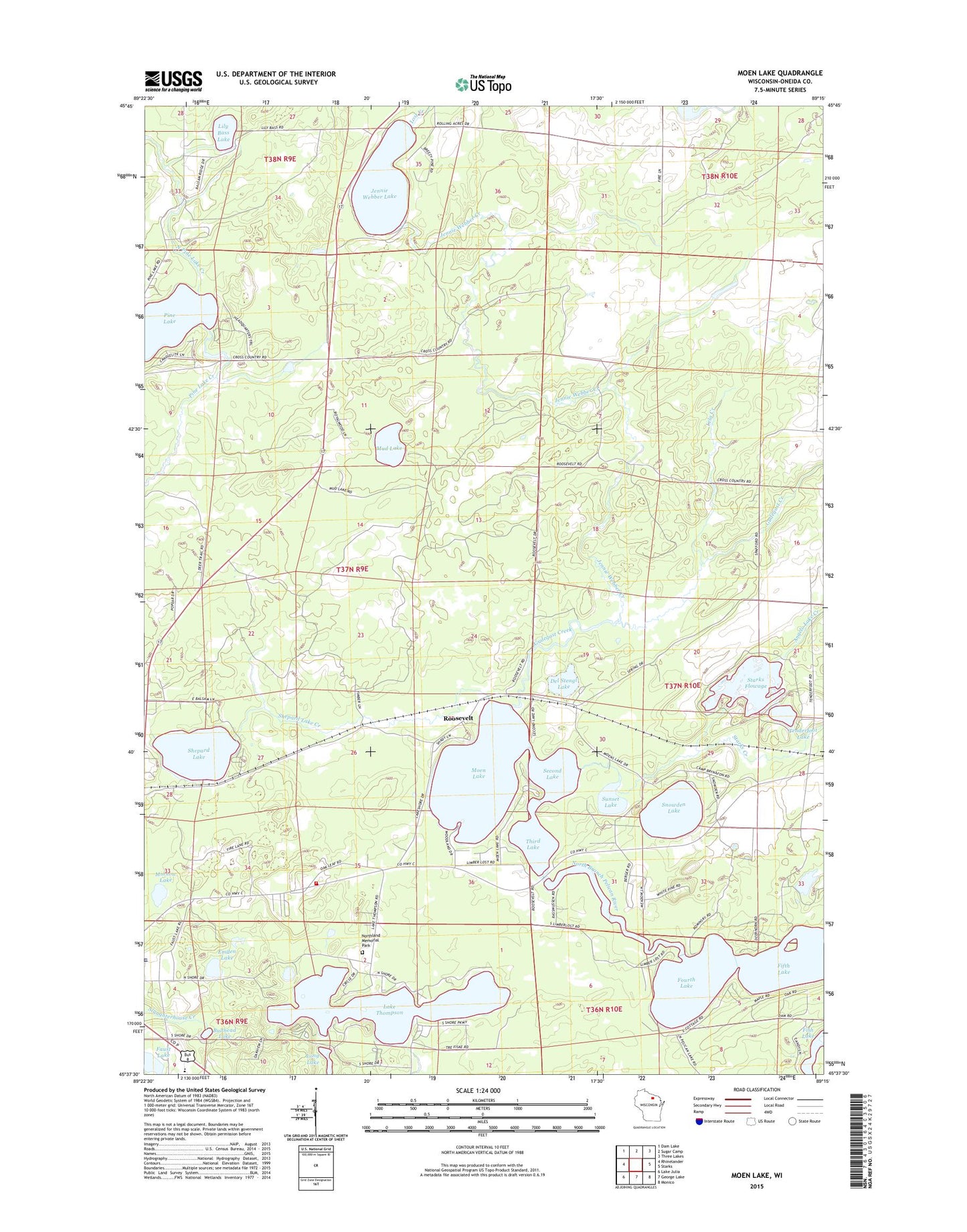
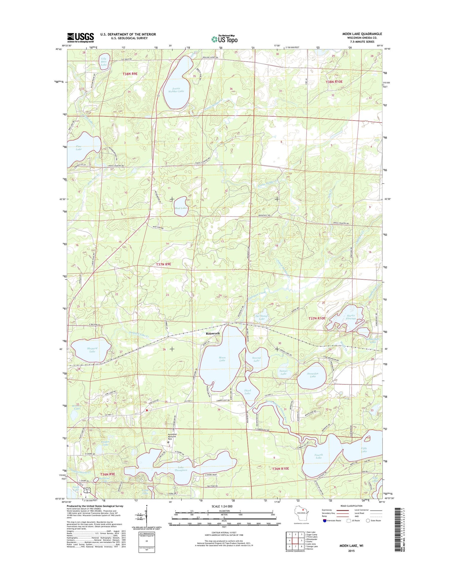
2018 topographic map quadrangle Moen Lake in the state of Wisconsin. Scale: 1:24000. Based on the newly updated USGS 7.5' US Topo map series, this map is in the following counties: Oneida. The map contains contour data, water features, and other items you are used to seeing on USGS maps, but also has updated roads and other features. This is the next generation of topographic maps. Printed on high-quality waterproof paper with UV fade-resistant inks.
Quads adjacent to this one:
West: Rhinelander
Northwest: Dam Lake
North: Sugar Camp
Northeast: Three Lakes
East: Starks
Southeast: Monico
South: George Lake
Southwest: Lake Julia
Contains the following named places: Angelo Lake Creek, Bernstein School, Bullhead Lake, Church of Christ, Del Stengl Lake, Emden Lake, Emden School, Faust Lake, Fifth Lake, Foursquare Church, Fourth Lake, Gudegast Creek, Hammel School, Jennie Webber Creek, Jennie Webber Lake, Kingdom Hall Church, Lake Thompson, Lela Creek, Lily Bass Lake, Long Lake, Lost Creek, Minnow Lake, Moen Lake, Mud Lake, North Pelican Lakes, North Pine Lake Creek, Northland Memorial Park, Oneida County Ambulance Rhinelander, Pelican Elementary School, Pine Lake, Pine Lake Fire Rescue Department - Station 2, Roosevelt, Saint Marys Hospital, Second Lake, Shepard Lake, Shepard Lake Creek, Snowden Lake, Sowinski Landing Field, Starks Creek, Starks Flowage, Sunset Lake, Tenderfoot Lake, Third Lake, WOBT-AM (Rhinelander), ZIP Code: 54501