MyTopo
Dam Lake Wisconsin US Topo Map
Couldn't load pickup availability
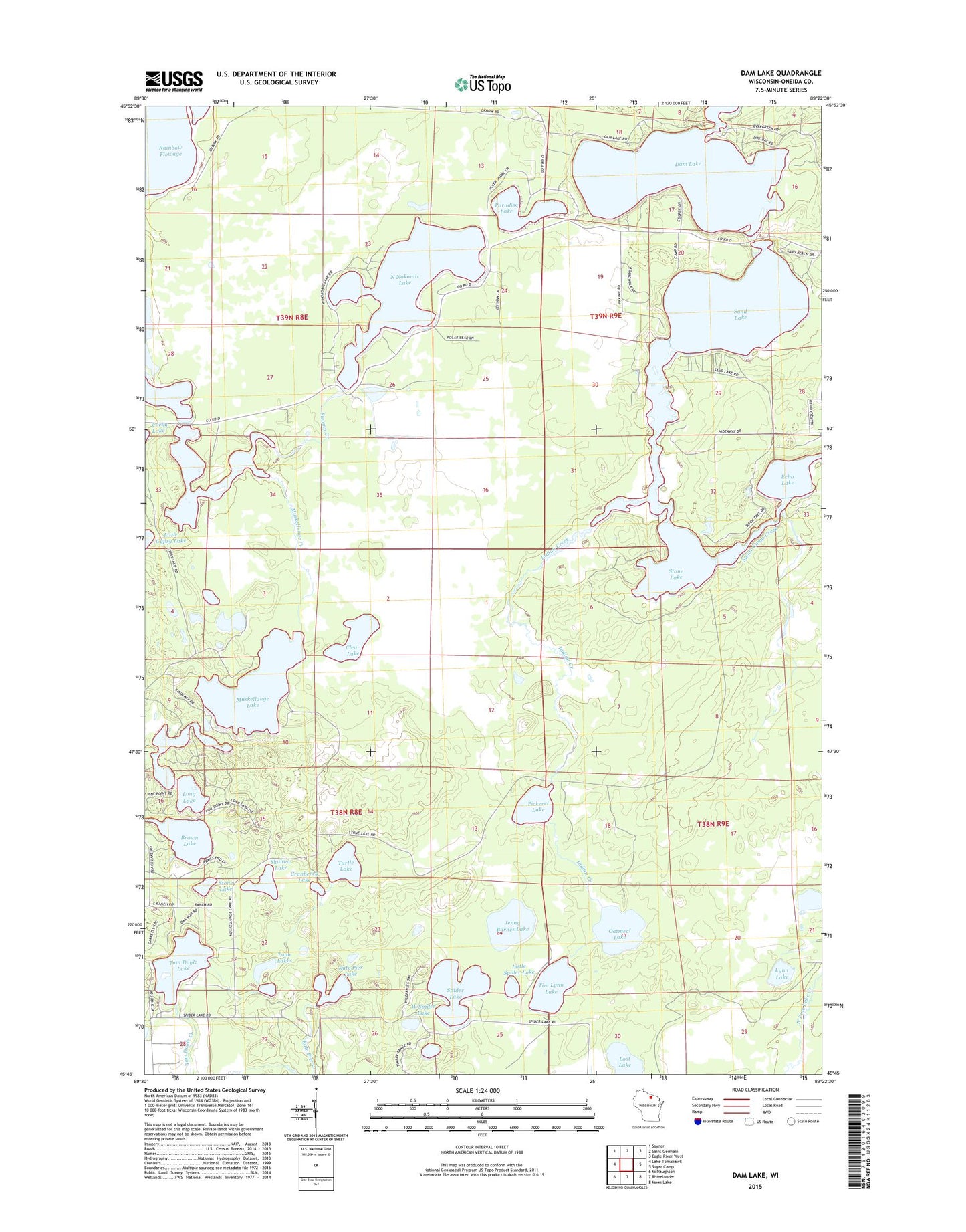
2022 topographic map quadrangle Dam Lake in the state of Wisconsin. Scale: 1:24000. Based on the newly updated USGS 7.5' US Topo map series, this map is in the following counties: Oneida. The map contains contour data, water features, and other items you are used to seeing on USGS maps, but also has updated roads and other features. This is the next generation of topographic maps. Printed on high-quality waterproof paper with UV fade-resistant inks.
Quads adjacent to this one:
West: Lake Tomahawk
Northwest: Sayner
North: Saint Germain
Northeast: Eagle River West
East: Sugar Camp
Southeast: Moen Lake
South: Rhinelander
Southwest: McNaughton
This map covers the same area as the classic USGS quad with code o45089g4.
Contains the following named places: American Legion State Forest, Brown Lake, Clear Lake, Cranberry Lake, Dam Sand Stone Echo Chain Lakes, Dam Lake, Echo Lake, Indian Creek, Jenny Barnes Lake, Kate Pier Creek, Kate Pier Lake, Little Spider Lake, Long Lake, Lost Lake, Lynn Lake, Muskellunge Creek, Muskellunge Lake, North Nokomis Lake, Oatmeal Lake, Paradise Lake, Pickerel Lake, Sand Lake, Shallow Lake, Spider Lake, Stone Lake, Stone Lake Pines State Natural Area, Sugar Camp 1909C361 Dam, Tim Lynn Lake, Tom Doyle Lake, Town of Newbold, Turtle Lake, Twin Lakes, West Spider Lake