MyTopo
Sugar Camp Wisconsin US Topo Map
Couldn't load pickup availability
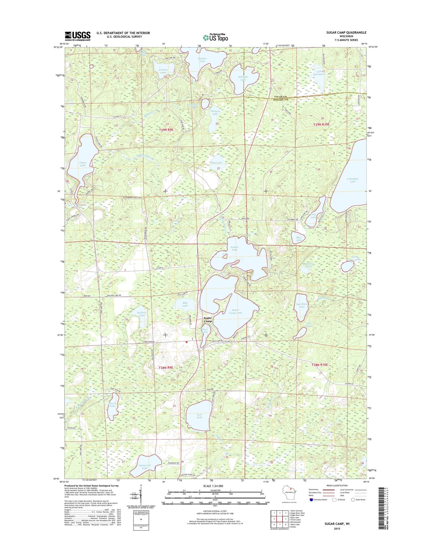
2022 topographic map quadrangle Sugar Camp in the state of Wisconsin. Scale: 1:24000. Based on the newly updated USGS 7.5' US Topo map series, this map is in the following counties: Oneida, Vilas. The map contains contour data, water features, and other items you are used to seeing on USGS maps, but also has updated roads and other features. This is the next generation of topographic maps. Printed on high-quality waterproof paper with UV fade-resistant inks.
Quads adjacent to this one:
West: Dam Lake
Northwest: Saint Germain
North: Eagle River West
Northeast: Eagle River East
East: Three Lakes
Southeast: Starks
South: Moen Lake
Southwest: Rhinelander
This map covers the same area as the classic USGS quad with code o45089g3.
Contains the following named places: Aldridge Lake, Arbutus Lake, Baggs Lake, Bass Lake, Bog Lake, Brown Creek, Burnham Creek, Burnham Lake, Chain Lake, Columbus Lake, Cranberry Lake, Deer Lake, Denton Lake, Haven Lake, Indian Chain Creek, Indian Lake, Indian Lookout Tower, John And Bud Lake, Jones Creek, Kathan Creek, Kathan Lake, Lake Seventeen, Lily Lake, Little Rice Lake, Long Lake, Lost Lake, Mill Lake, Minnow Lake, Oneida County Ambulance Sugar Camp, Sugar Camp, Sugar Camp Elementary School, Sugar Camp Fire Department, Sugar Camp Lake, Sundstien School, Tamarack Lake, Town of Sugar Camp, Walters Lake