MyTopo
Mount Vernon Wisconsin US Topo Map
Couldn't load pickup availability
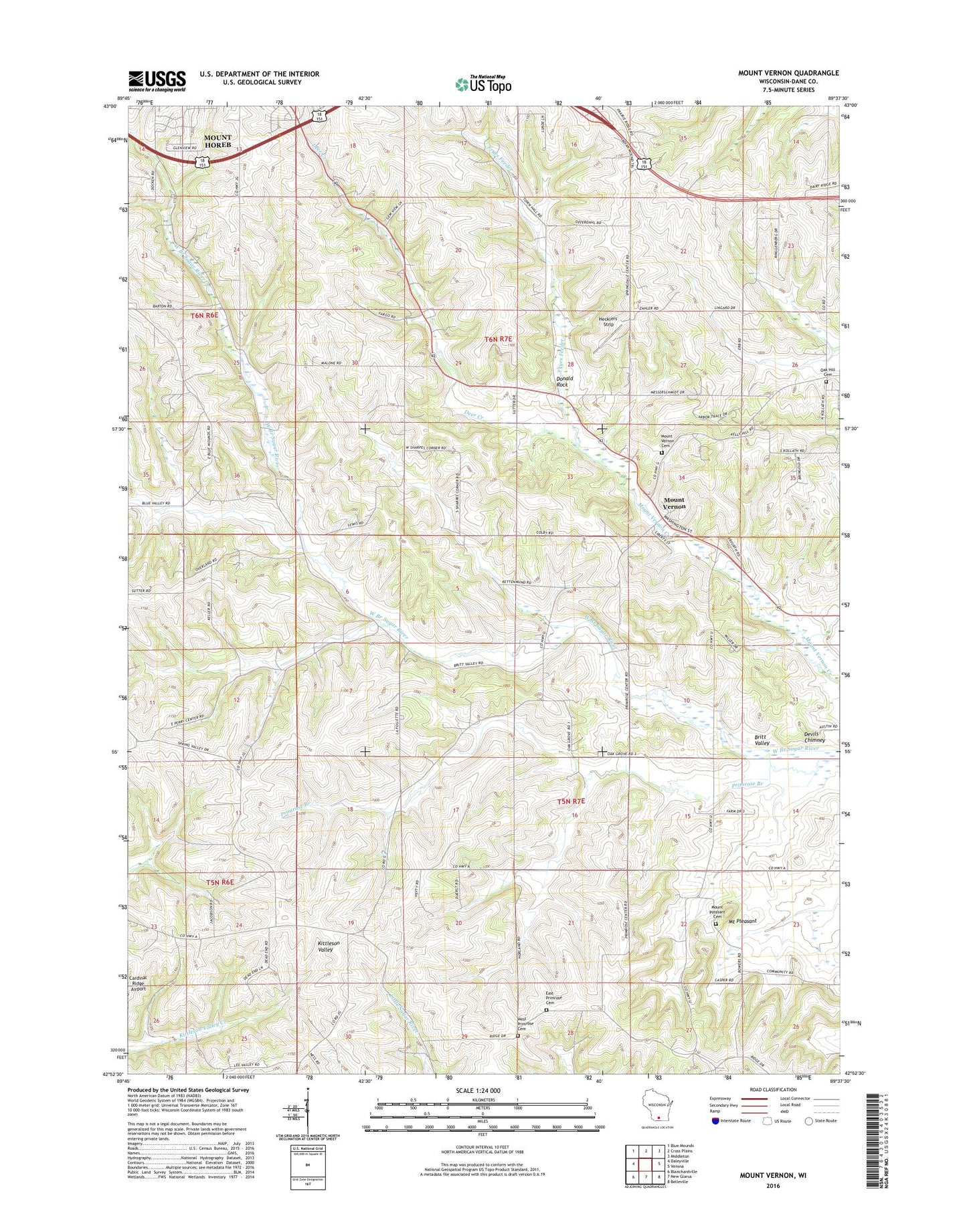
2018 topographic map quadrangle Mount Vernon in the state of Wisconsin. Scale: 1:24000. Based on the newly updated USGS 7.5' US Topo map series, this map is in the following counties: Dane. The map contains contour data, water features, and other items you are used to seeing on USGS maps, but also has updated roads and other features. This is the next generation of topographic maps. Printed on high-quality waterproof paper with UV fade-resistant inks.
Quads adjacent to this one:
West: Daleyville
Northwest: Blue Mounds
North: Cross Plains
Northeast: Middleton
East: Verona
Southeast: Belleville
South: New Glarus
Southwest: Blanchardville
Contains the following named places: Britt Valley, Britt Valley School, Cat Nip Hollow Farm, Deer Creek, Devils Chimney, Dixon School, Donald Rock, East Blue Mounds Church, East Blue Mounds Lutheran Cemetery, East Primrose Cemetery, Fryes Feeder, Gonstead Airport, Hecklers' Strip, Liberty Farm, Mount Horeb Wastewater Treatment Facility, Mount Pleasant, Mount Pleasant Cemetery, Mount Vernon, Mount Vernon Cemetery, Mount Vernon Landing Strip, Mount Vernon School, Oak Hill Cemetery, Primrose, Primrose Branch, Primrose Lutheran Church, Sutter's Ridge Farm, Town of Primrose, Town of Springdale, West Primrose Cemetery, ZIP Code: 53572