MyTopo
New Glarus Wisconsin US Topo Map
Couldn't load pickup availability
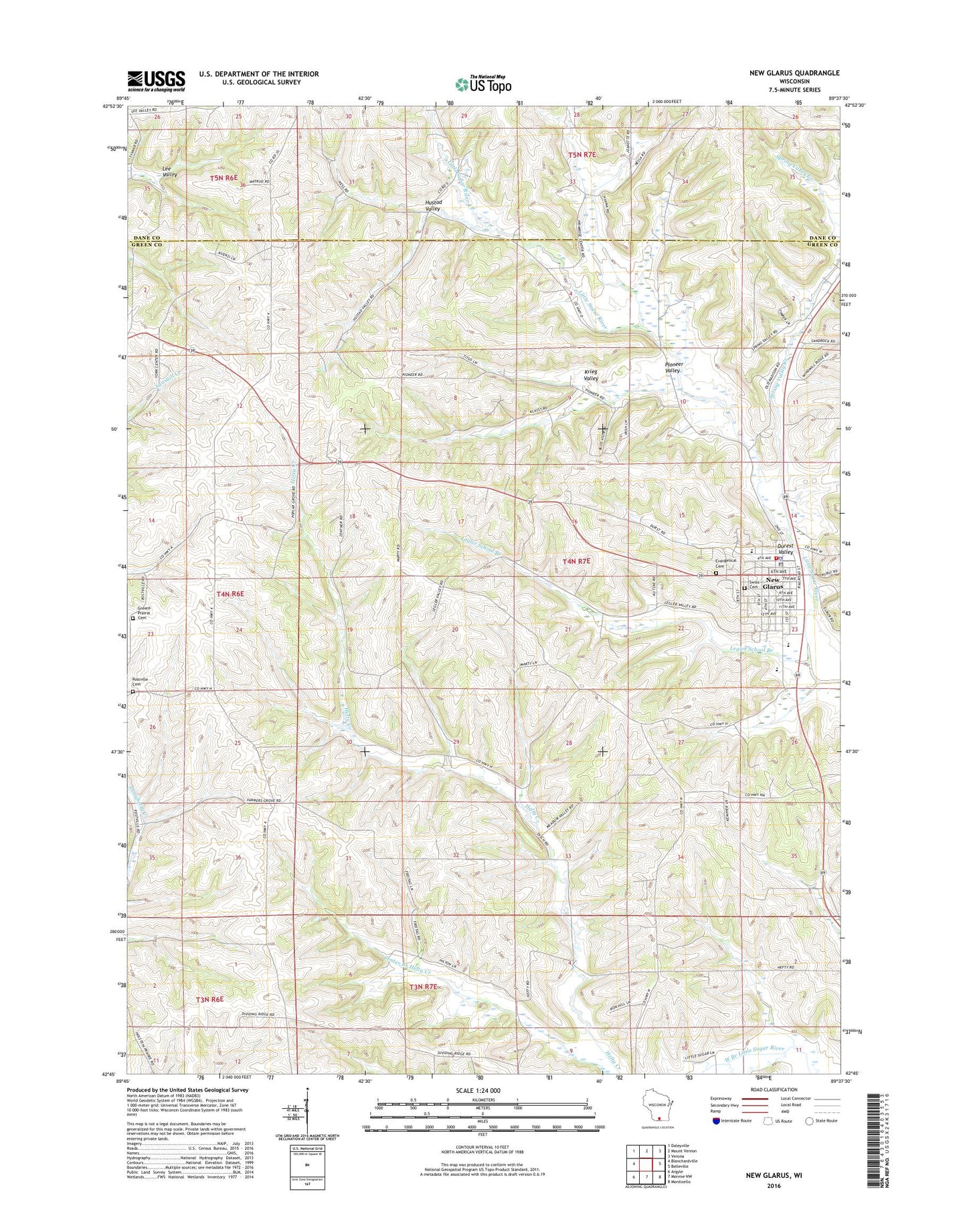
2022 topographic map quadrangle New Glarus in the state of Wisconsin. Scale: 1:24000. Based on the newly updated USGS 7.5' US Topo map series, this map is in the following counties: Green, Dane. The map contains contour data, water features, and other items you are used to seeing on USGS maps, but also has updated roads and other features. This is the next generation of topographic maps. Printed on high-quality waterproof paper with UV fade-resistant inks.
Quads adjacent to this one:
West: Blanchardville
Northwest: Daleyville
North: Mount Vernon
Northeast: Verona
East: Belleville
Southeast: Monticello
South: Monroe NW
Southwest: Argyle
This map covers the same area as the classic USGS quad with code o42089g6.
Contains the following named places: Country Hills Farm, Durest Valley, Evangelical United Brethren Cemetery, Farmers Grove, Greens Prairie Cemetery, Hustad Valley, Kadence Farm, Karlen Dairy Farm, Krieg Valley, Legler School Branch, New Glarus, New Glarus Christian School, New Glarus City Hall, New Glarus Dairy, New Glarus Elementary School, New Glarus Emergency Medical Service, New Glarus Middle / High School, New Glarus Police Department, New Glarus Post Office, New Glarus Volunteer Fire Department, New Glarus Wastewater Treatment Plant, New Glarus Woods State Park, Nixiebabes Dairy Farm, Pioneer Valley, Pisgah Evangelical United Brethren Church, Postville Cemetery, Prairie Ridge Farm, Rainbow Fleece Farm, Southside Mobile Home Park, Spring Valley Creek, Swiss Reformed Cemetery, Swiss United Church of Christ, Town of New Glarus, Village of New Glarus, ZIP Code: 53574