MyTopo
Blanchardville Wisconsin US Topo Map
Couldn't load pickup availability
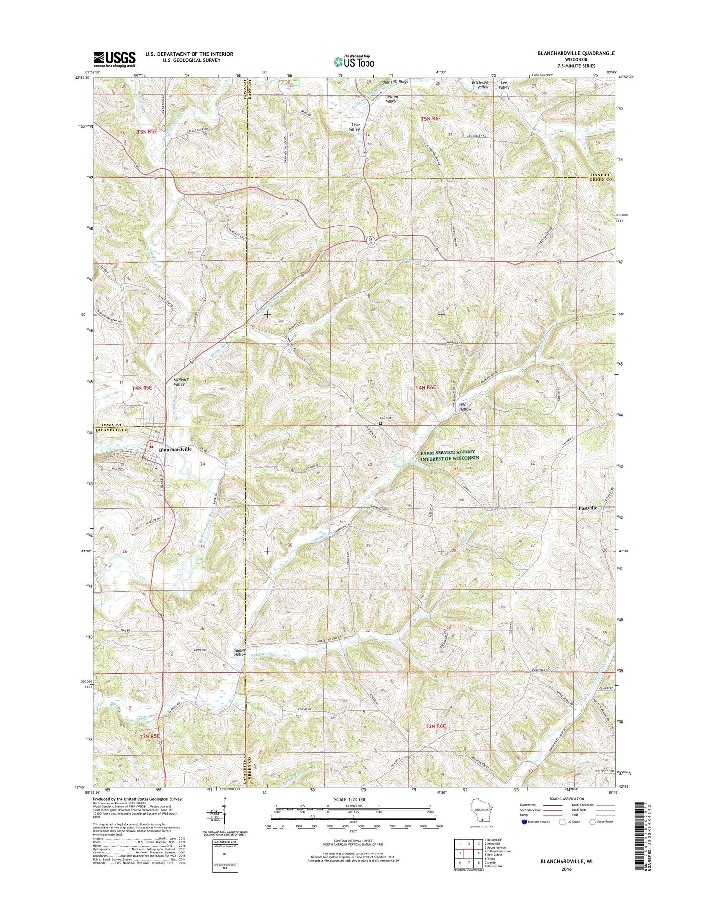
2022 topographic map quadrangle Blanchardville in the state of Wisconsin. Scale: 1:24000. Based on the newly updated USGS 7.5' US Topo map series, this map is in the following counties: Green, Lafayette, Iowa, Dane. The map contains contour data, water features, and other items you are used to seeing on USGS maps, but also has updated roads and other features. This is the next generation of topographic maps. Printed on high-quality waterproof paper with UV fade-resistant inks.
Quads adjacent to this one:
West: Yellowstone Lake
Northwest: Hollandale
North: Daleyville
Northeast: Mount Vernon
East: New Glarus
Southeast: Monroe NW
South: Argyle
Southwest: Wiota
This map covers the same area as the classic USGS quad with code o42089g7.
Contains the following named places: 0.47 Reservoir, 53516, Adams Church, Bakers Field, Blanchardville, Blanchardville Fire Department, Blanchardville Lutheran Church, Blanchardville Police Department, Blanchardville Post Office, Blanchardville Village Hall, Blanchardville Wastewater Treatment Facility, Brager Branch, Einerson School, Erickson Creek, Gordon Creek, Hay Hollow, Immaculate Conception Catholic Church, Jeglum Valley, Kittleson Valley Creek, Lee Valley, Loyalty School, McCoy G 9648 Dam, McKellar Park, McPeace Valley, McPeace Valley Creek, Meadowview School, Moscow, Pecatonica Christian Preschool, Pecatonica High School, Postville, Sawmill Creek, Step Valley, Syftestad Creek, Town of York, Trinity Lutheran Church, Ula Cemetery, Village of Blanchardville, Yankee Hollow, York Church, York Memorial Church, York Prairie State Natural Area