MyTopo
Verona Wisconsin US Topo Map
Couldn't load pickup availability
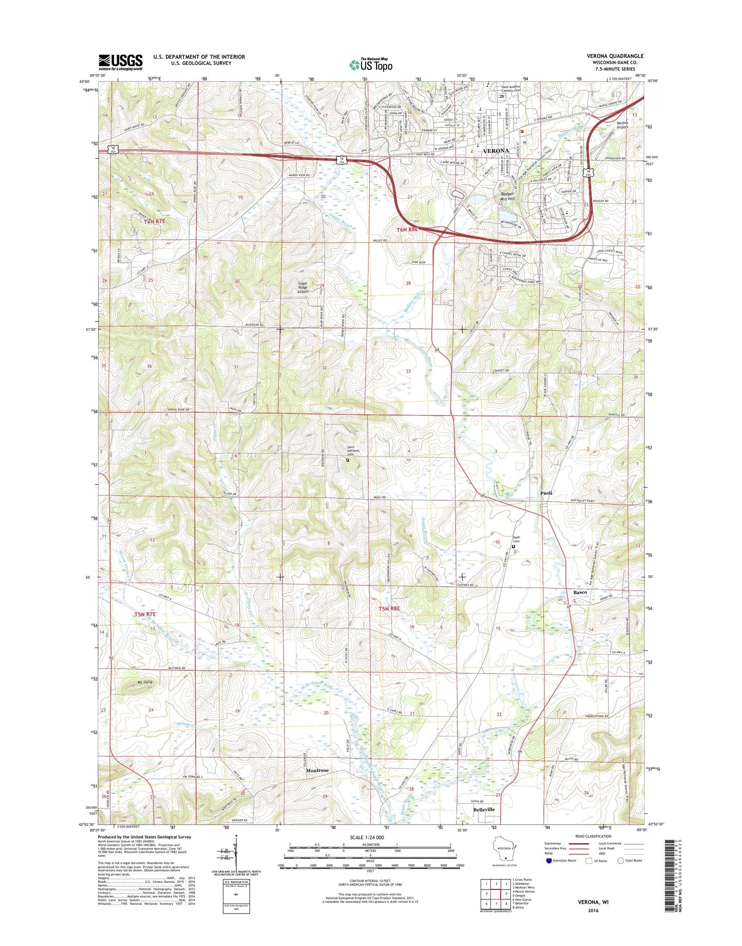
2022 topographic map quadrangle Verona in the state of Wisconsin. Scale: 1:24000. Based on the newly updated USGS 7.5' US Topo map series, this map is in the following counties: Dane. The map contains contour data, water features, and other items you are used to seeing on USGS maps, but also has updated roads and other features. This is the next generation of topographic maps. Printed on high-quality waterproof paper with UV fade-resistant inks.
Quads adjacent to this one:
West: Mount Vernon
Northwest: Cross Plains
North: Middleton
Northeast: Madison West
East: Oregon
Southeast: Attica
South: Belleville
Southwest: New Glarus
This map covers the same area as the classic USGS quad with code o42089h5.
Contains the following named places: Badger Mill Creek, Badger Mill Hill, Badger Prairie County Park, Badger Ridge Middle School, Basco, City of Verona, Core Knowledge Charter School, Dane County Farm, Fitch - Rona Emergency Medical Services, Flynn Creek, Frenchtown Cemetery, Glacier Edge Elementary School, Harker School, McPherson School, Milum Creek, Montrose, Montrose Pioneer Cemetery, Mount Julia, Mount Vernon Creek, New Century School, Olson Oak Woods State Natural Area, Paoli, Paoli Cemetery, Saint Andrew Catholic Cemetery, Saint William Catholic Cemetery, Schaller School, Sugar Creek Elementary School, Sugar Ridge Airport, Sugar River Wetlands State Natural Area, Town of Montrose, Town of Verona, Valley View School, Verona, Verona Airport, Verona Area High School, Verona Area Middle School, Verona Cemetery, Verona Fire Department, Verona Police Department, Verona Post Office, ZIP Code: 53593