
MyTopo
Namur Wisconsin US Topo Map
Couldn't load pickup availability
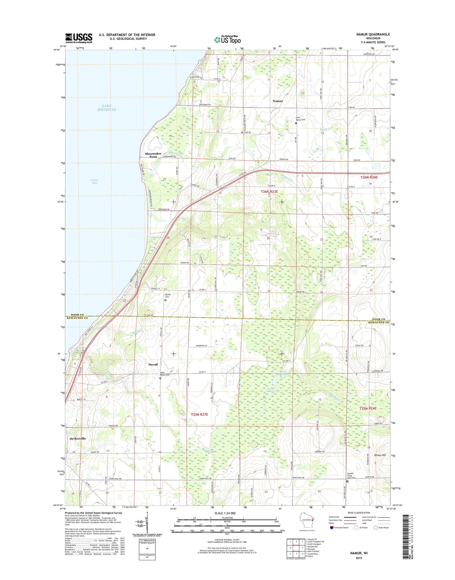
2018 topographic map quadrangle Namur in the state of Wisconsin. Scale: 1:24000. Based on the newly updated USGS 7.5' US Topo map series, this map is in the following counties: Door, Kewaunee. The map contains contour data, water features, and other items you are used to seeing on USGS maps, but also has updated roads and other features. This is the next generation of topographic maps. Printed on high-quality waterproof paper with UV fade-resistant inks.
Quads adjacent to this one:
West: Dyckesville
Northwest: Oconto SE
North: Little Sturgeon SW
Northeast: Little Sturgeon
East: Brussels
Southeast: Casco
South: Luxemburg
Southwest: New Franken
Contains the following named places: Baudhuin Farms, Bay View, Bramblewood Farm, Chaudoirs Dock County Park, Degrave Farms, Duvall, Duvall Cemetery, Duvall Swamp, Gospel Truth Hall, Gospel Truth Hall Cemetery, High View School, Little Mud Lake, Macco Creek, Mick Schier Field Airport, Murray Sand and Gravel Pit, Namur, Norkin Farms, Pleasant Ridge School, Red River, Red River County Park, Red River Valley Farms, Renard Creek, Rocky Glen School, Saint Francis Catholic Church, Saint Marys Cemetery, San Sauveur School, Shoemaker Point, Sylvan Orchard, Tassout Farm, Town of Red River, Town of Union, WHET-FM (Sturgeon Bay)


