MyTopo
Natzke Camp Wisconsin US Topo Map
Couldn't load pickup availability
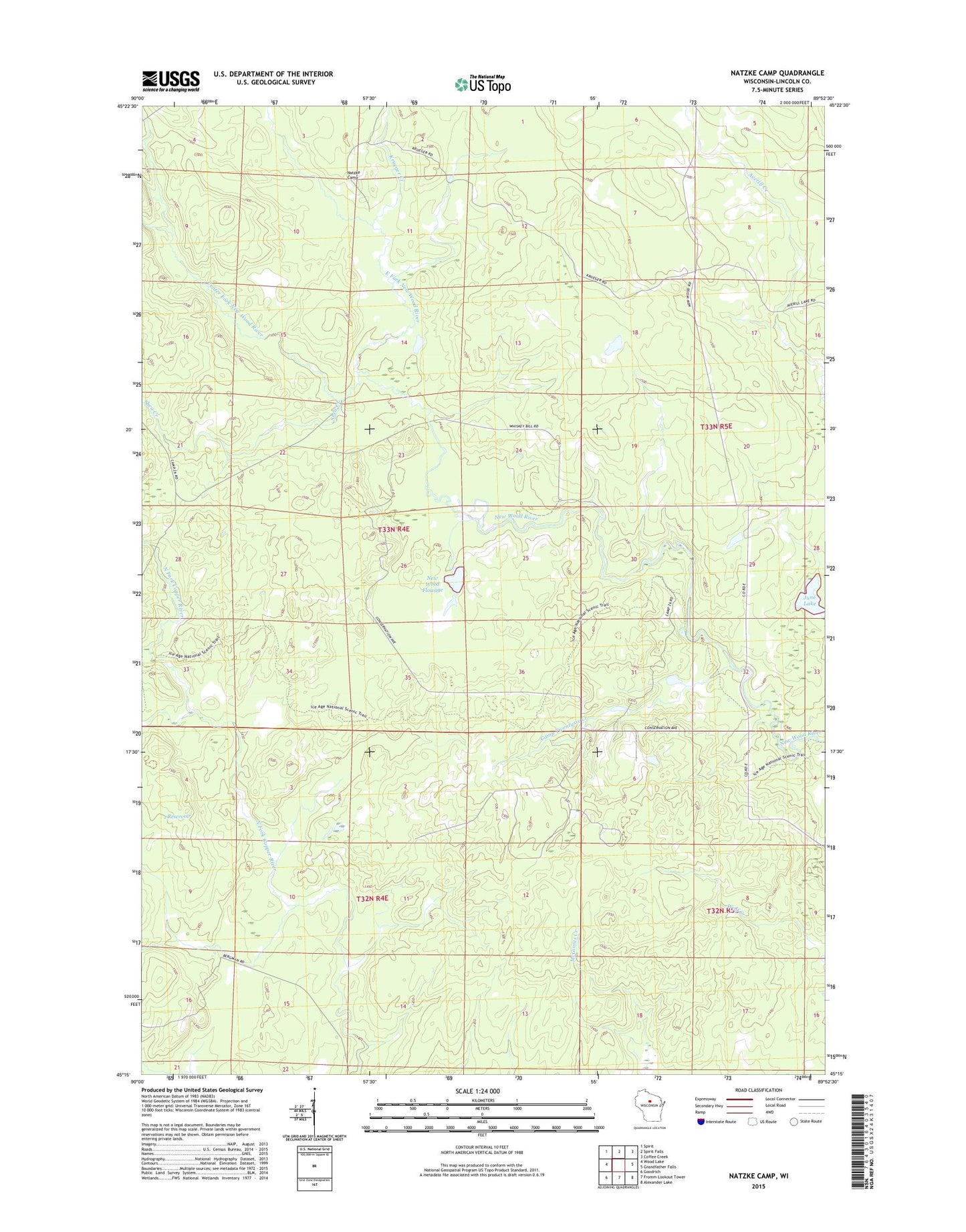
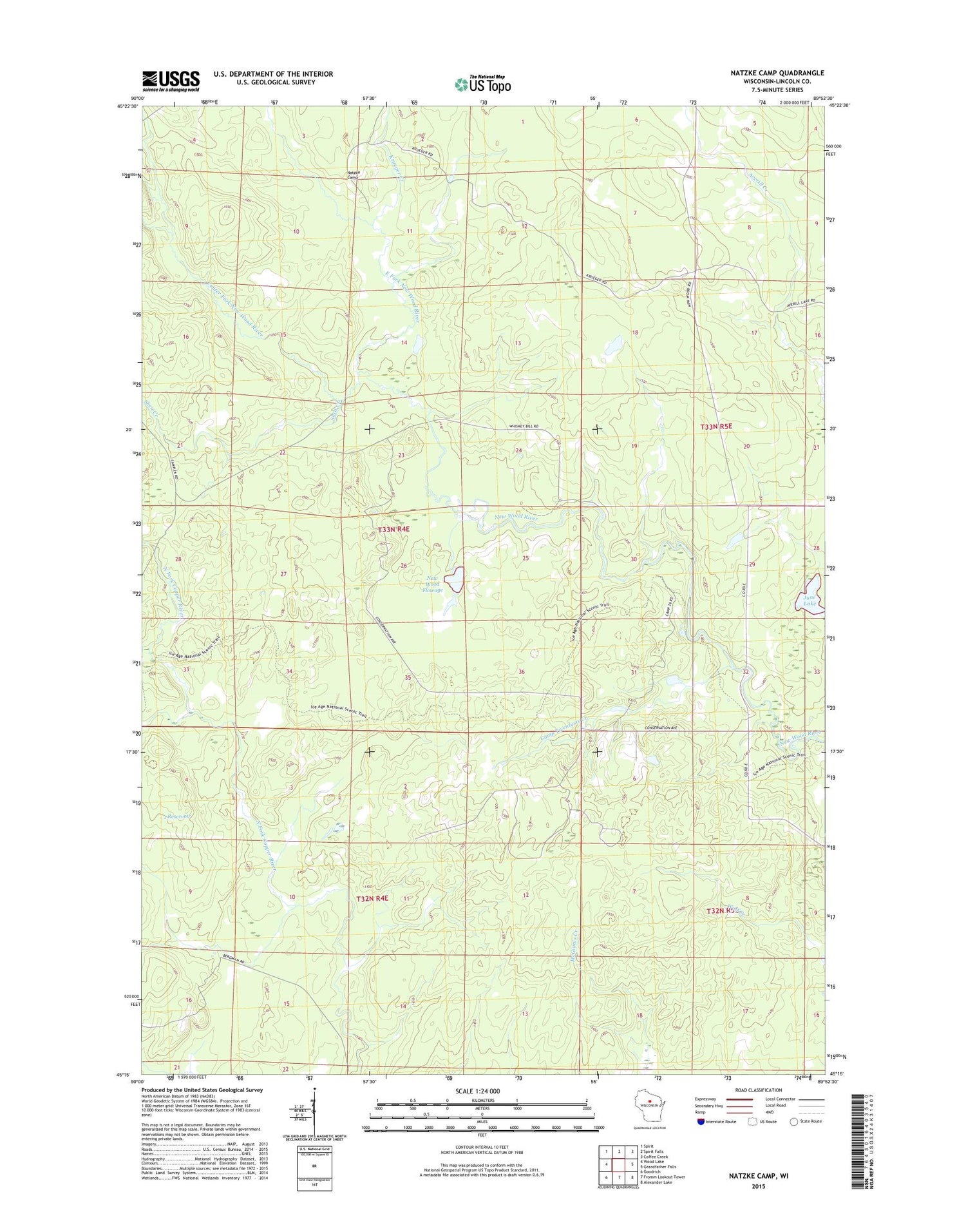
2018 topographic map quadrangle Natzke Camp in the state of Wisconsin. Scale: 1:24000. Based on the newly updated USGS 7.5' US Topo map series, this map is in the following counties: Lincoln. The map contains contour data, water features, and other items you are used to seeing on USGS maps, but also has updated roads and other features. This is the next generation of topographic maps. Printed on high-quality waterproof paper with UV fade-resistant inks.
Quads adjacent to this one:
West: Wood Lake
Northwest: Spirit
North: Spirit Falls
Northeast: Coffee Creek
East: Grandfather Falls
Southeast: Alexander Lake
South: Fromm Lookout Tower
Southwest: Goodrich
Contains the following named places: 1 Reservoir, Averill Junction, Camp Twenty-five, Camp Twenty-seven, Camp Twentysix Creek, Center Fork New Wood River, East Fork New Wood River, June Lake, Krueger Creek, Mravik E-7031 Dam, Natzke Camp, New Wood, New Wood Creek, New Wood Flowage, New Wood H2.117 Dam, New Wood State Public Hunting Grounds, Shea Creek