MyTopo
Spirit Wisconsin US Topo Map
Couldn't load pickup availability
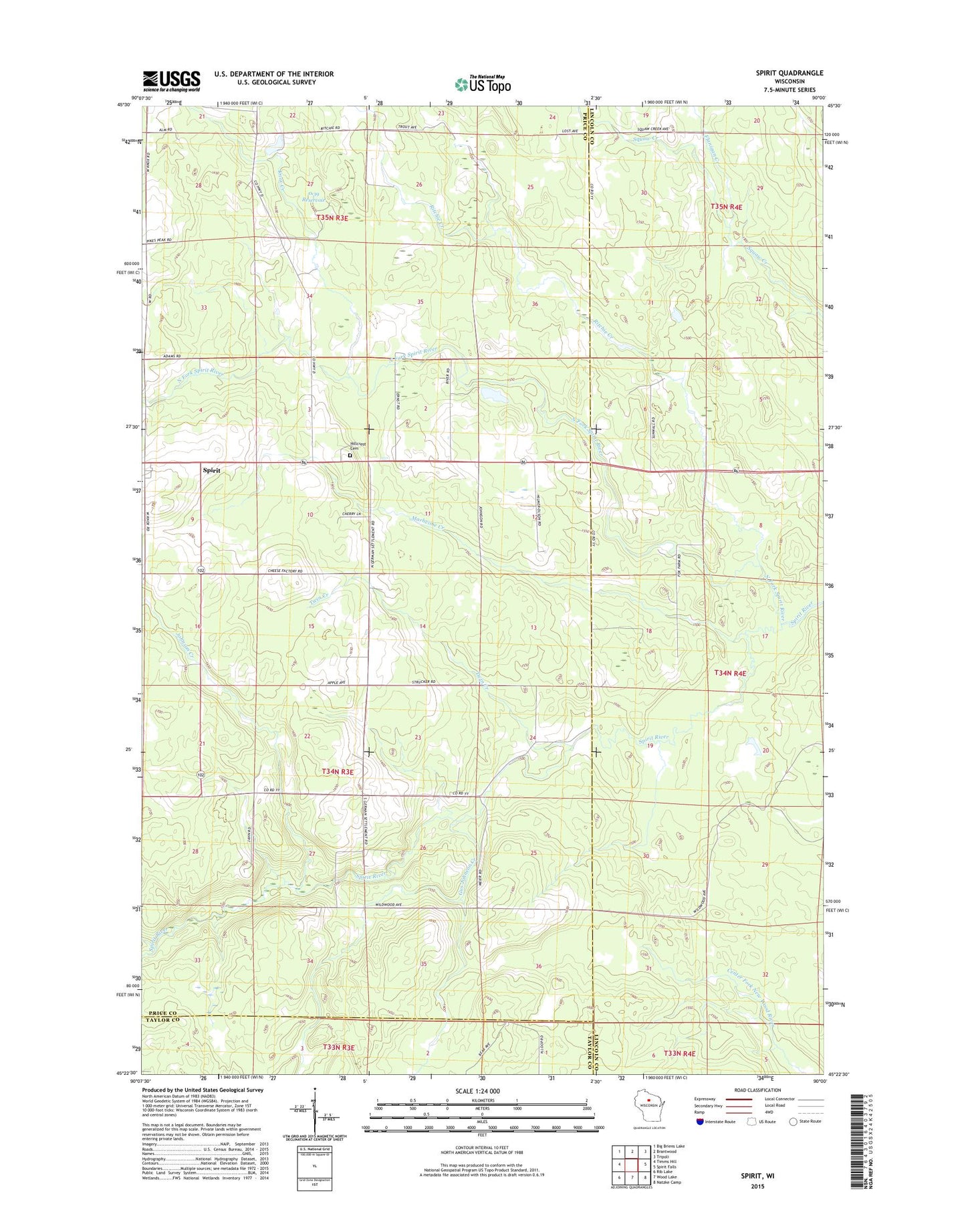
2023 topographic map quadrangle Spirit in the state of Wisconsin. Scale: 1:24000. Based on the newly updated USGS 7.5' US Topo map series, this map is in the following counties: Price, Lincoln, Taylor. The map contains contour data, water features, and other items you are used to seeing on USGS maps, but also has updated roads and other features. This is the next generation of topographic maps. Printed on high-quality waterproof paper with UV fade-resistant inks.
Quads adjacent to this one:
West: Timms Hill
Northwest: Big Briens Lake
North: Brantwood
Northeast: Tripoli
East: Spirit Falls
Southeast: Natzke Camp
South: Wood Lake
Southwest: Rib Lake
This map covers the same area as the classic USGS quad with code o45090d1.
Contains the following named places: 1 Reservoir, Flanigan Creek, Gus Johnson Creek, Hillcrest Cemetery, Johnson Creek, Knox Creek, Liberty School, Marheime Creek, Mission Church, North Fork Spirit River, Ritchie Creek, Spirit, Spirit Center School, Spirit Townhall, Thomas Breakey and Ray Bush G5995 Dam, Town of Spirit, Twin Creek, Wilson School