
MyTopo
New Richmond North Wisconsin US Topo Map
Couldn't load pickup availability
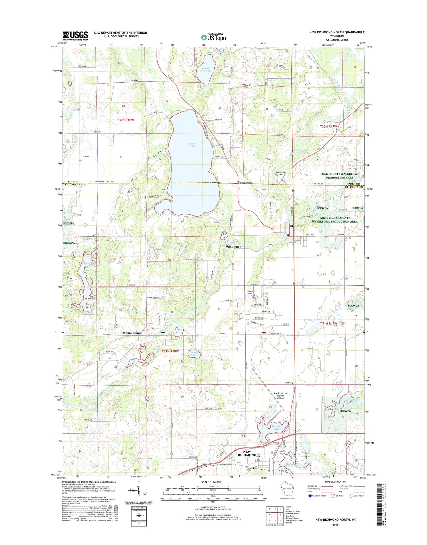
2018 topographic map quadrangle New Richmond North in the state of Wisconsin. Scale: 1:24000. Based on the newly updated USGS 7.5' US Topo map series, this map is in the following counties: St. Croix, Polk. The map contains contour data, water features, and other items you are used to seeing on USGS maps, but also has updated roads and other features. This is the next generation of topographic maps. Printed on high-quality waterproof paper with UV fade-resistant inks.
Quads adjacent to this one:
West: Somerset North
Northwest: Osceola
North: Nye
Northeast: Wapogasset Lake
East: Deer Park
Southeast: Jewett
South: New Richmond South
Southwest: Somerset South
Contains the following named places: Cedar Creek, Cedar Lake, Cedar Lake School, Ceder Lake Seaplane Base, Danielson Field, First Baptist Church, First Lutheran Church, Hatfield Lake, Hatfield Park, Hexum Flight Park, Horse Creek, Huntington, Johannesburg, Life Link New Richmond Ambulance Service, Lower Pine Lake, Mary Park, Munson Lake, New Richmond City Landfill, New Richmond Fire Department Star Prairie Station, New Richmond Regional Airport, Northside Park, Oakland Cemetery, Prairie View School, River View School, Saint Croix Health Center, Squaw Lake, Squaw Lake School, Stanton Townhall, Star Prairie, Star Prairie Police Department, Star Prairie Post Office, Star Prairie Townhall, Strand Lake, Swedish Evangelical Lutheran Church, Town of Star Prairie, Village of Star Prairie, Wall Street Village, Woodbridge Trailer Court, Woodridge Mobile Home Park, ZIP Code: 54026


