MyTopo
Wapogasset Lake Wisconsin US Topo Map
Couldn't load pickup availability
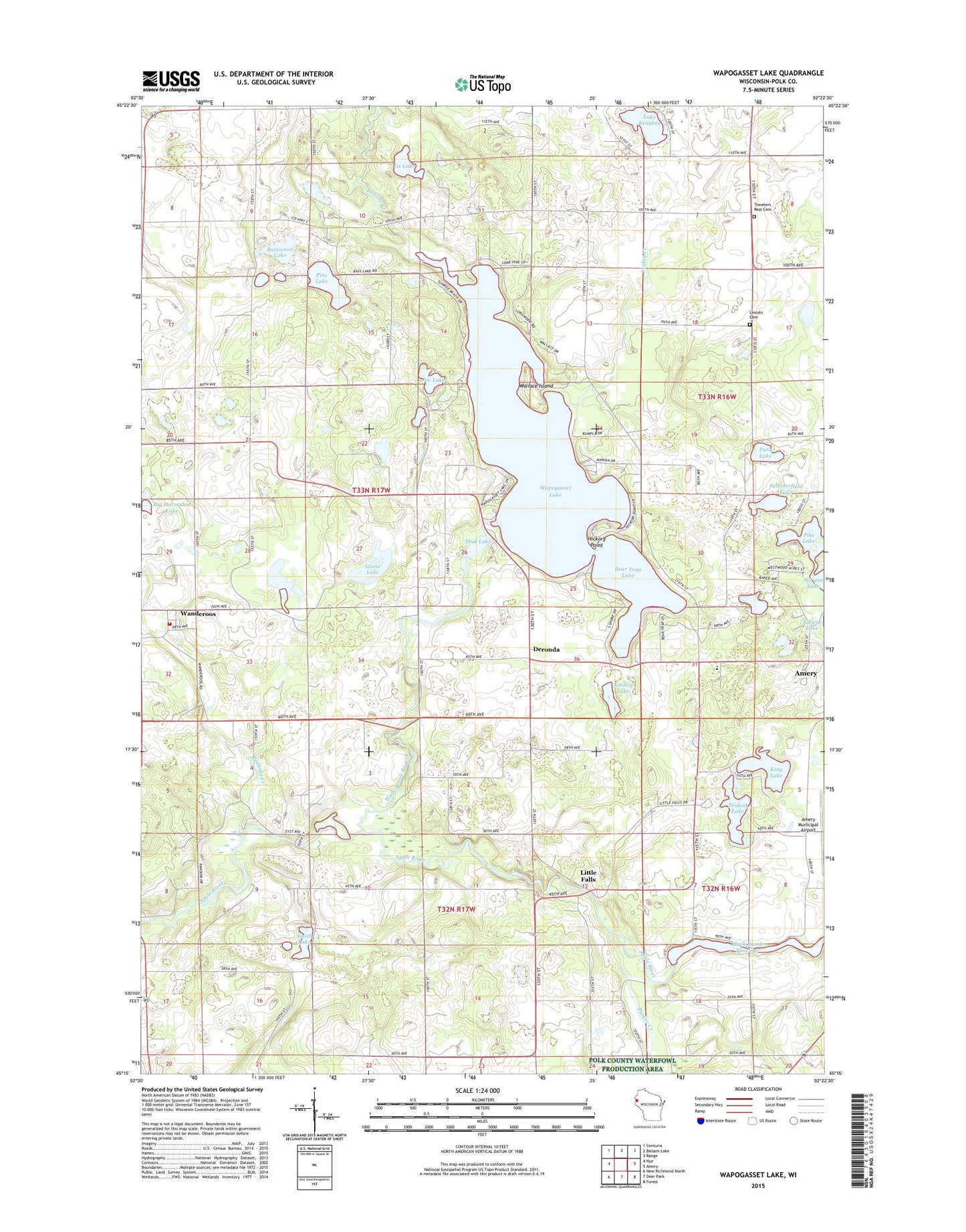
2022 topographic map quadrangle Wapogasset Lake in the state of Wisconsin. Scale: 1:24000. Based on the newly updated USGS 7.5' US Topo map series, this map is in the following counties: Polk. The map contains contour data, water features, and other items you are used to seeing on USGS maps, but also has updated roads and other features. This is the next generation of topographic maps. Printed on high-quality waterproof paper with UV fade-resistant inks.
Quads adjacent to this one:
West: Nye
Northwest: Centuria
North: Balsam Lake
Northeast: Range
East: Amery
Southeast: Forest
South: Deer Park
Southwest: New Richmond North
This map covers the same area as the classic USGS quad with code o45092c4.
Contains the following named places: Amery Airport, Balsam Branch, Balsam Branch State Wildlife Area, Basswood Lake, Bear Lake School, Bear Trap Lake, Big Horseshoe Lake, Black Brook County Park, Black Brook Flowage, Black Brook WP-66 Dam, Camp Icaghowan, Deronda, Dresser - Osceola - Garfield Fire Association Garfield Station, Friday Creek, Goose Lake, Hickory Point, High Bridge School, Joe Lake, King Lake, Kinney Lake, Lake Kenabee, Lincoln Cemetery, Little Falls, Lutheran Bible Camp, Mud Lake, Mustard Seed Faith Academy, Oak Grove School, Ox Lake, Park Lake, Parker Creek, Parker Creek State Public Fishing Area, Peabody Creek, Pine Lake, Pleasant View School, Polk County Home, Smith Lake, Sucker Lake School, Summerfield Lake, Town of Garfield, Travelers Rest Cemetery, Trident Lake, Trinity Church, Volga School, Wallace Island, Wanderoos, Wapogasset Branch, Wapogasset Lake, Youngs Landing Strip, ZIP Code: 54001