MyTopo
Osceola Wisconsin US Topo Map
Couldn't load pickup availability
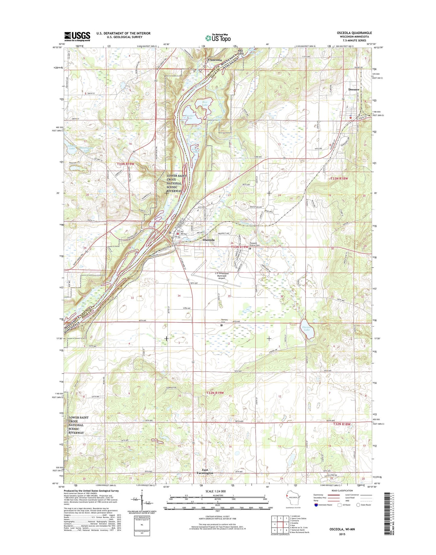
2022 topographic map quadrangle Osceola in the states of Wisconsin, Minnesota. Scale: 1:24000. Based on the newly updated USGS 7.5' US Topo map series, this map is in the following counties: Polk, Chisago, Washington. The map contains contour data, water features, and other items you are used to seeing on USGS maps, but also has updated roads and other features. This is the next generation of topographic maps. Printed on high-quality waterproof paper with UV fade-resistant inks.
Quads adjacent to this one:
West: Scandia
Northwest: Lindstrom
North: Saint Croix Dalles
Northeast: Centuria
East: Nye
Southeast: New Richmond North
South: Somerset North
This map covers the same area as the classic USGS quad with code o45092c6.
Contains the following named places: Close Slough, Closses Creek, Dresser, Dresser - Osceola - Garfield Fire Association Dresser Station, Dresser Elementary School, Dresser Police Department, Dresser Post Office, East Farmington, Elmgrove School, Farmington Center School, Folsom Lake, Forest View School, Four-H Park, Franconia, Franconia Post Office, Hawkinson Lake, Johnson Lake, Kroy-Osceola Heliport, L O Simenstad Municipal Airport, Lawrence Creek, Lower Lake, Lower Saint Croix National Scenic Riverway, Osceola, Osceola Air Force Station, Osceola Bedrock Glades State Natural Area, Osceola Career Charter School, Osceola Charter Preschool, Osceola Creek, Osceola Elementary School, Osceola Fire and Rescue, Osceola High School, Osceola Intermediate School, Osceola Lake, Osceola Medical Center, Osceola Middle School, Osceola Police Department, Osceola Post Office, Osceola State Fish Hatchery, Peaslee Lake, Pleasant Prairie Cemetery, Ramsey Cemetery, Rice Lake, Rock Island, Town of Farmington, Townhall, Valley Christian School, Village of Dresser, Village of Osceola, ZIP Code: 54020