MyTopo
New Richmond South Wisconsin US Topo Map
Couldn't load pickup availability
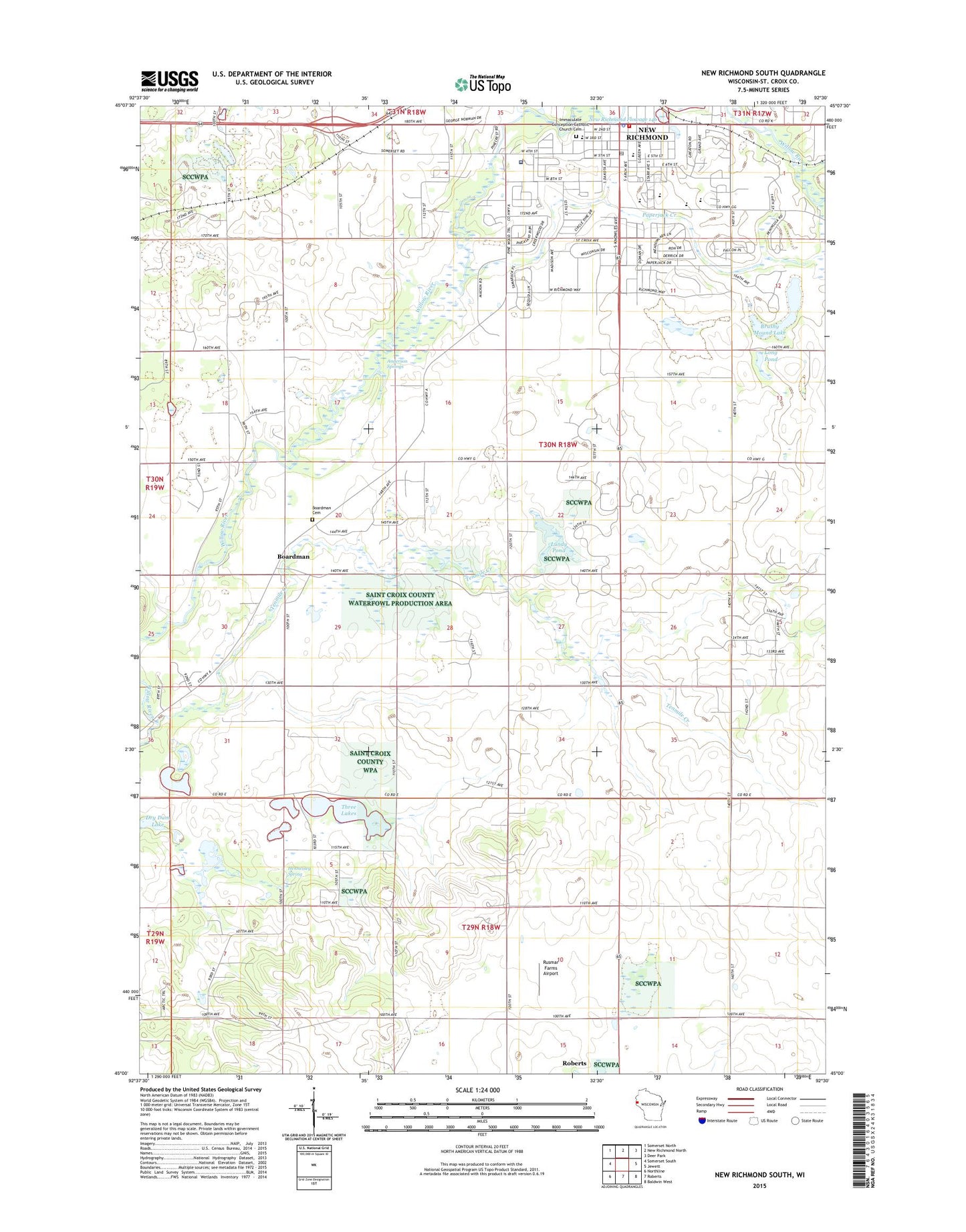
2018 topographic map quadrangle New Richmond South in the state of Wisconsin. Scale: 1:24000. Based on the newly updated USGS 7.5' US Topo map series, this map is in the following counties: St. Croix. The map contains contour data, water features, and other items you are used to seeing on USGS maps, but also has updated roads and other features. This is the next generation of topographic maps. Printed on high-quality waterproof paper with UV fade-resistant inks.
Quads adjacent to this one:
West: Somerset South
Northwest: Somerset North
North: New Richmond North
Northeast: Deer Park
East: Jewett
Southeast: Baldwin West
South: Roberts
Southwest: Northline
Contains the following named places: Anderson Springs, Boardman, Boardman Cemetery, Brushy Mound Lake, Carleton A Friday Memorial Library, Citizens Field, City of New Richmond, Clarendon School, Flying M Ranch Airport, Glover Park, Hennessey Spring, Immaculate Conception Catholic Church, Immaculate Conception Catholic Church Cemetery, Lonesome Trail School, Long Pond, Lundy Pond, Monette Park, New Richmond, New Richmond Area Ambulance, New Richmond Fire and Rescue, New Richmond Flowage 146, New Richmond Golf Course, New Richmond High School, New Richmond Middle School, New Richmond Mills Dam, New Richmond Police Department, New Richmond Post Office, NR4Kids Charter School, Oak Hill School, Paper Jack Park, Paperjack Creek, Paperjack Elementary School, Riverside, Rusmar Farms Airport, Saint Mary School, Spring Brook School, Starr Elementary School, Tenmile Creek, Three Lakes, Town of Richmond, Twin Pond School, Westfields Hospital, WIXK-AM (New Richmond), WIXK-FM (New Richmond), ZIP Code: 54017