MyTopo
Oneida North Wisconsin US Topo Map
Couldn't load pickup availability
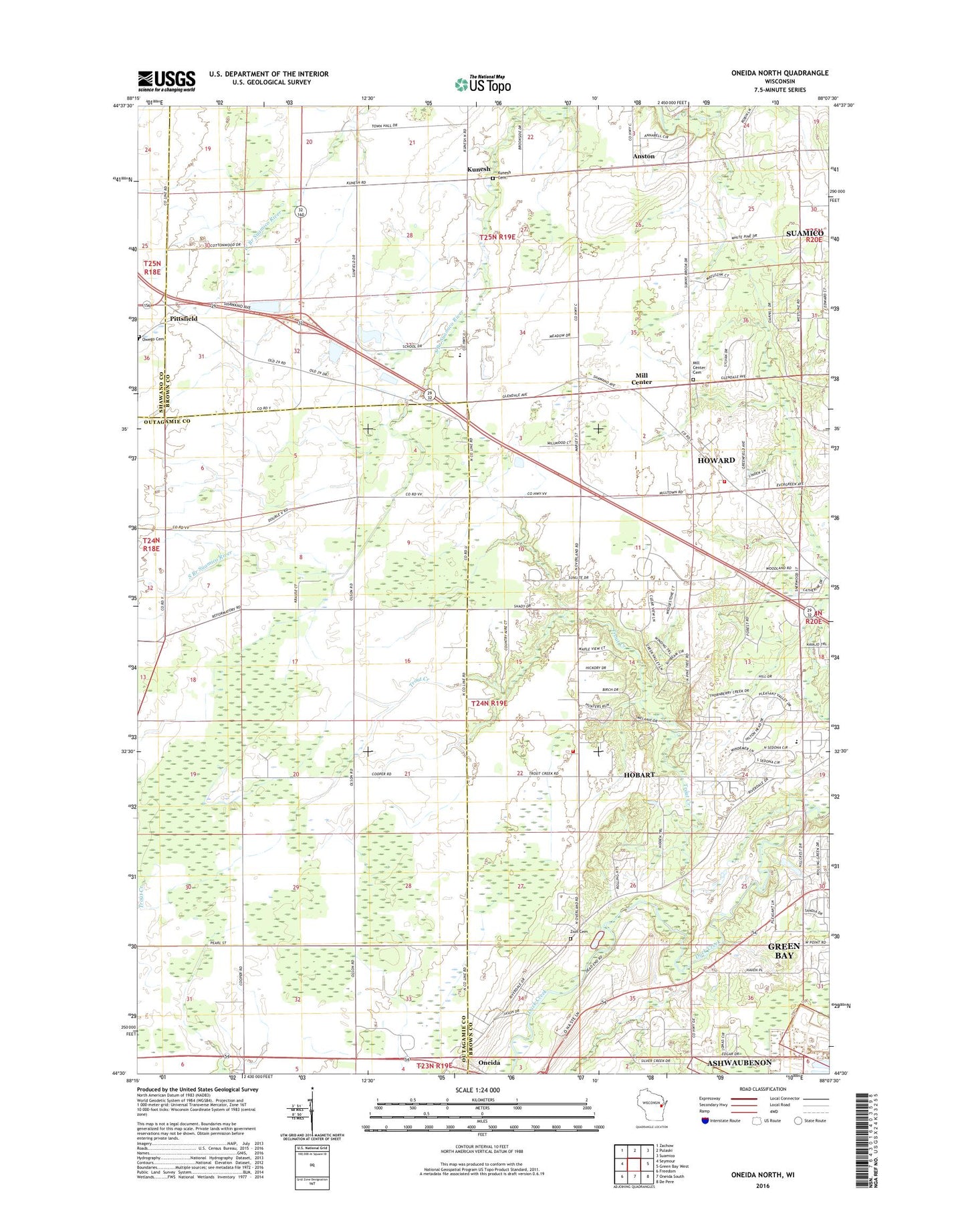
2018 topographic map quadrangle Oneida North in the state of Wisconsin. Scale: 1:24000. Based on the newly updated USGS 7.5' US Topo map series, this map is in the following counties: Brown, Outagamie, Shawano. The map contains contour data, water features, and other items you are used to seeing on USGS maps, but also has updated roads and other features. This is the next generation of topographic maps. Printed on high-quality waterproof paper with UV fade-resistant inks.
Quads adjacent to this one:
West: Seymour
Northwest: Zachow
North: Pulaski
Northeast: Suamico
East: Green Bay West
Southeast: De Pere
South: Oneida South
Southwest: Freedom
Contains the following named places: Anston, Hillcrest Elementary School, Howard Fire Station, Kunesh, Kunesh Cemetery, Lannoye Elementary School, Lannoye School, Mill Center, Mill Centre Cemetery, Mission Church, Oneida Apple Orchard, Oneida Post Office, Peace Church, Pittsfield, Red Leaf Nursery, Seymour School, South Branch Suamico River, Trout Creek, Trout Creek School, Village of Hobart Fire and Rescue Station 2, West Branch Suamico River, Zion Lutheran Cemetery, ZIP Code: 54155