MyTopo
Freedom Wisconsin US Topo Map
Couldn't load pickup availability
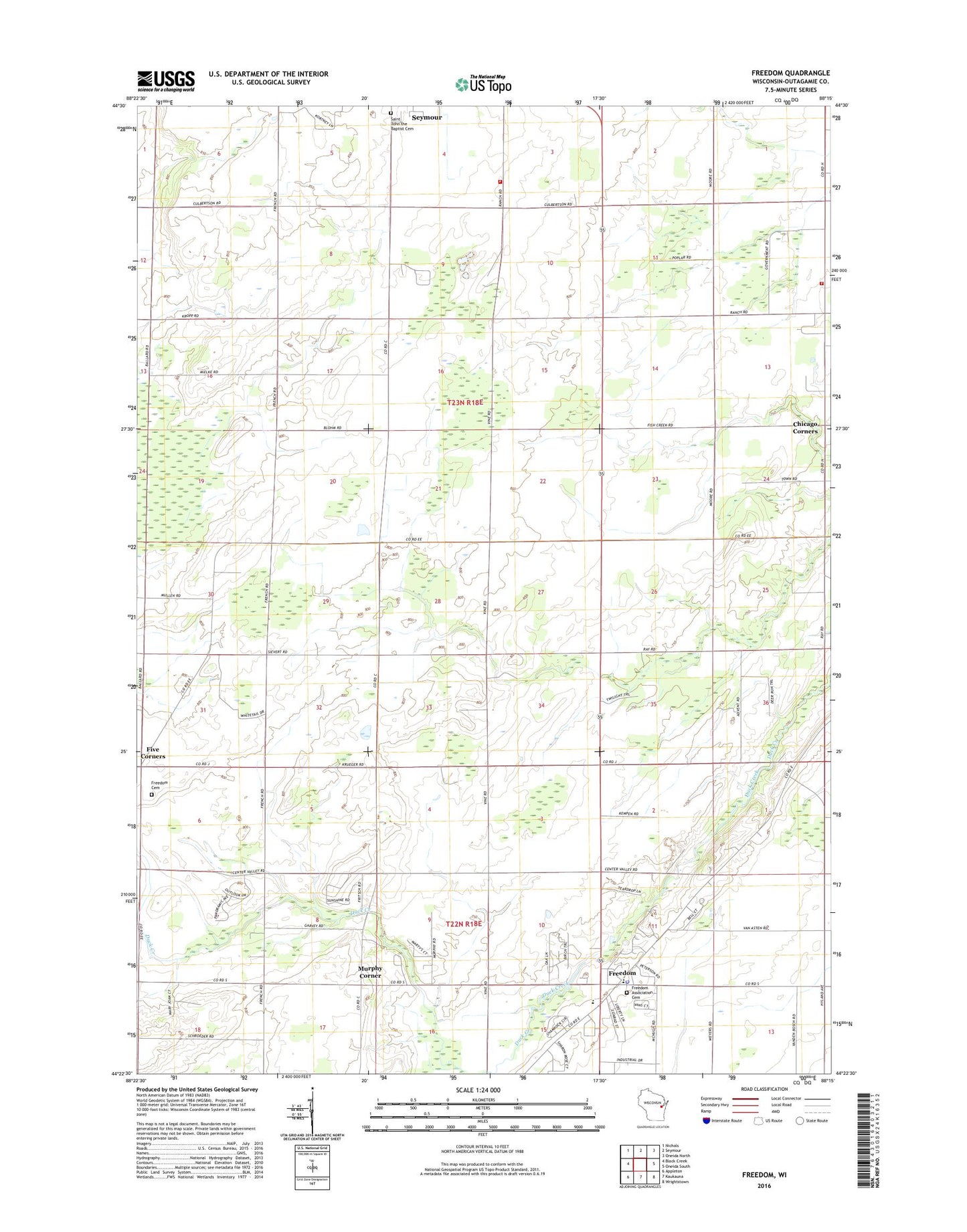
2022 topographic map quadrangle Freedom in the state of Wisconsin. Scale: 1:24000. Based on the newly updated USGS 7.5' US Topo map series, this map is in the following counties: Outagamie. The map contains contour data, water features, and other items you are used to seeing on USGS maps, but also has updated roads and other features. This is the next generation of topographic maps. Printed on high-quality waterproof paper with UV fade-resistant inks.
Quads adjacent to this one:
West: Black Creek
Northwest: Nichols
North: Seymour
Northeast: Oneida North
East: Oneida South
Southeast: Wrightstown
South: Kaukauna
Southwest: Appleton
This map covers the same area as the classic USGS quad with code o44088d3.
Contains the following named places: Chicago Corners, Elm Hill School, Five Corners, Freedom, Freedom Cemetery, Freedom High School, Freedom Middle School, Freedom Police Department, Golden Rule School, Maple Grove School, Moravian Church of Freedom, Murphy Corner, North Osborn School, Oneida Township Volunteer Fire Department, Osborn Fire Department, Pioneer School, Saint John Catholic Cemetery, Saint Nicholas Catholic Church, Saint Nicholas Catholic School, Saint Nicholas Cemetery, Shuh Quarry, Town of Osborn, VFW Memorial Park, Woodside School