MyTopo
Suamico Wisconsin US Topo Map
Couldn't load pickup availability
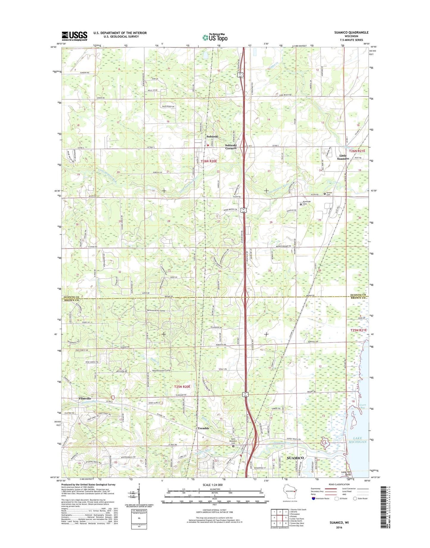
2022 topographic map quadrangle Suamico in the state of Wisconsin. Scale: 1:24000. Based on the newly updated USGS 7.5' US Topo map series, this map is in the following counties: Oconto, Brown. The map contains contour data, water features, and other items you are used to seeing on USGS maps, but also has updated roads and other features. This is the next generation of topographic maps. Printed on high-quality waterproof paper with UV fade-resistant inks.
Quads adjacent to this one:
West: Pulaski
Northwest: Oconto Falls South
North: Abrams
Northeast: Pensaukee
East: Little Tail Point
Southeast: Green Bay East
South: Green Bay West
Southwest: Oneida North
This map covers the same area as the classic USGS quad with code o44088f1.
Contains the following named places: Cottonwood Grove School, Dewey School, EJ Smith County Park, Flintville, Grosse Cemetery, Haller Creek, Little Suamico, Little Suamico Fire Department, Little Suamico Post Office, Locust Grove School, Riverside Cemetery, Saint Benedict Catholic Cemetery, Saint Pats Park, Saints Edward and Isidore Church, Sensiba State Wildlife Area, Sobieski, Sobieski Census Designated Place, Sobieski Corners, Suamico, Suamico Elementary School, Suamico Fire Department - Station 1, Suamico Post Office, Suamico River, Town of Little Suamico, Town of Suamico, Tremble, Village of Suamico, West Lakeside Park, West Side School, Woodview School, ZIP Codes: 54171, 54173