MyTopo
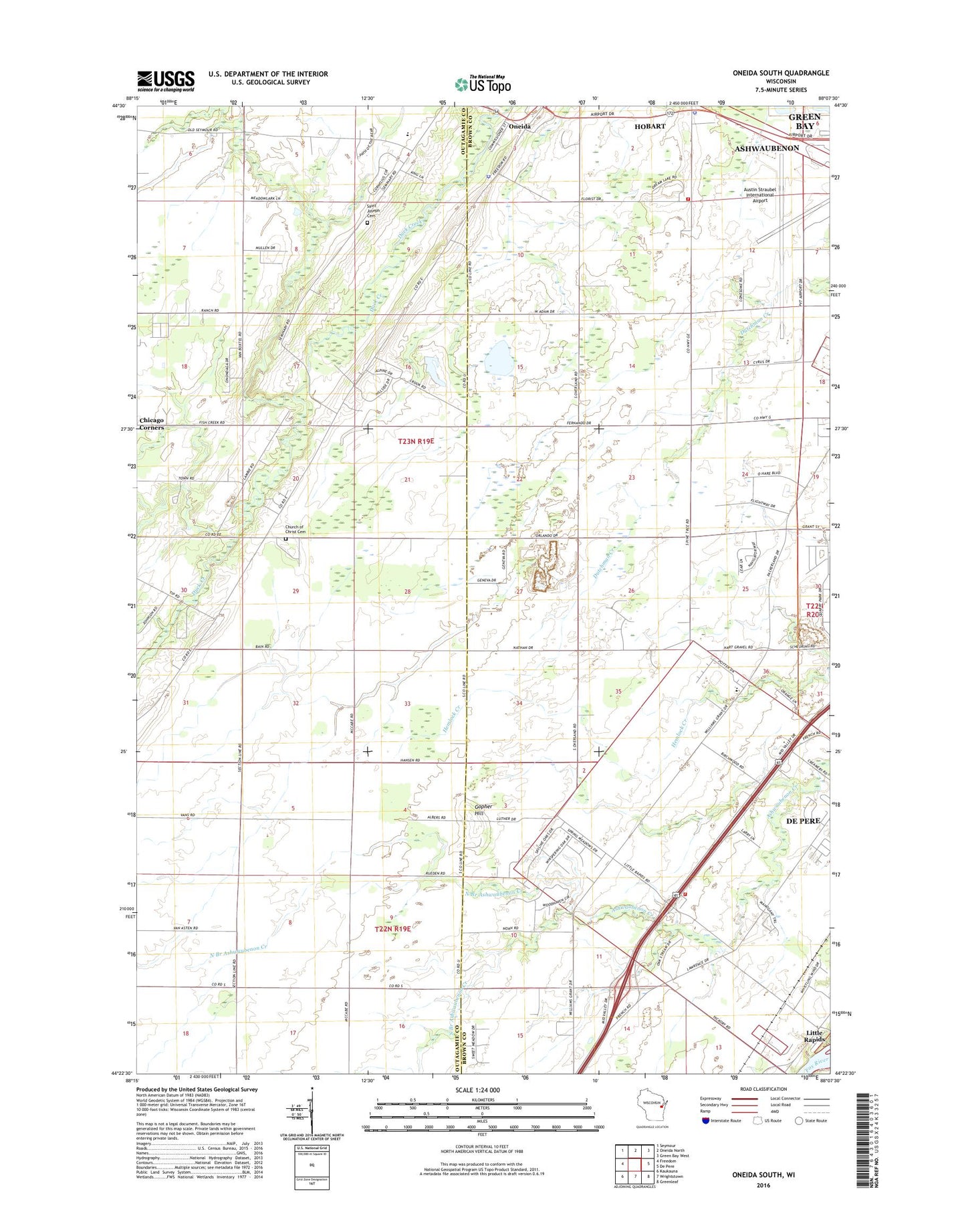
Oneida South Wisconsin US Topo Map
Couldn't load pickup availability
2022 topographic map quadrangle Oneida South in the state of Wisconsin. Scale: 1:24000. Based on the newly updated USGS 7.5' US Topo map series, this map is in the following counties: Brown, Outagamie. The map contains contour data, water features, and other items you are used to seeing on USGS maps, but also has updated roads and other features. This is the next generation of topographic maps. Printed on high-quality waterproof paper with UV fade-resistant inks.
Quads adjacent to this one:
West: Freedom
Northwest: Seymour
North: Oneida North
Northeast: Green Bay West
East: De Pere
Southeast: Greenleaf
South: Wrightstown
Southwest: Kaukauna
This map covers the same area as the classic USGS quad with code o44088d2.
Contains the following named places: Austin Straubel International Airport Fire Department, Beauty Grove School, Church of Christ Cemetery, Ebbens Quarry, Gopher Hill, Green Bay-Austin Straubel International Airport, Hemlock Creek Elementary School, High View School, Hobart, Hobart - Lawrence Police Department, Hobart Volunteer Fire Department 1, Holy Apostles Church, Immaculate Conception School, Lawrence School, Lawrence Township Fire Department - Station 1, Little Rapids, Mayflower Greenhouse, North Branch Ashwaubenon Creek, Old Glory School, Oneida, Oneida Church, Oneida Nation Elementary and Middle School, Oneida Police Department, Oneida Reservation, Sacred Heart Center, Saint Joseph Cemetery, Silvery Summit School, South Branch Ashwaubenon Creek, Town of Hobart, Town of Lawrence, Town of Oneida, Village of Hobart