MyTopo
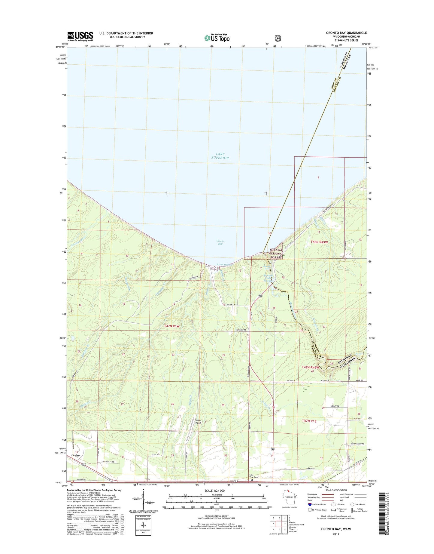
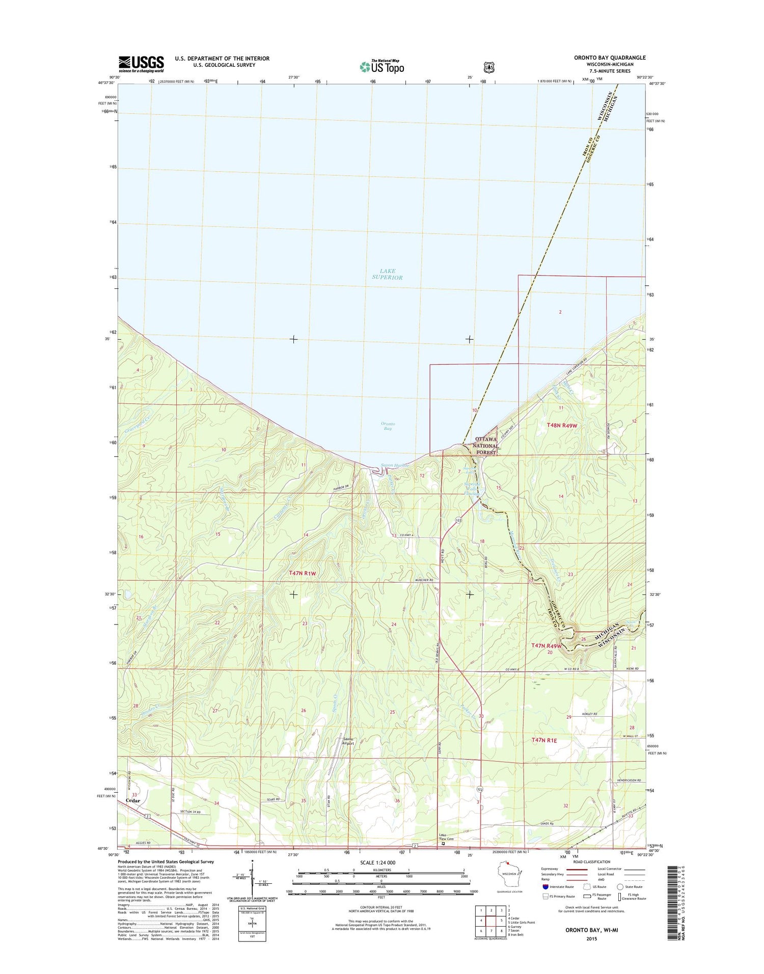
Oronto Bay Wisconsin US Topo Map
Couldn't load pickup availability
2018 topographic map quadrangle Oronto Bay in the states of Wisconsin, Michigan. Scale: 1:24000. Based on the newly updated USGS 7.5' US Topo map series, this map is in the following counties: Iron, Gogebic. The map contains contour data, water features, and other items you are used to seeing on USGS maps, but also has updated roads and other features. This is the next generation of topographic maps. Printed on high-quality waterproof paper with UV fade-resistant inks.
Quads adjacent to this one:
West: Cedar
East: Little Girls Point
Southeast: Iron Belt
South: Saxon
Southwest: Gurney
Contains the following named places: Carpenter Creek, Cedar, Flink Creek, Graveyard Creek, Lake View Cemetery, Legion County Park, Maki Creek, Montreal River, Oronto Bay, Oronto Creek, Parker Creek, Peterson Chapel, Saxon Airport, Saxon Falls, Saxon Falls Hydro Generating Station, Saxon Harbor, Saxon Harbor County Park, Saxon Union Church, Spoon Creek, Sturgeon Branch, Superior Falls, Superior Falls Flowage, Superior Falls Hydro Generating Station, Town of Saxon, Treasure Creek