MyTopo
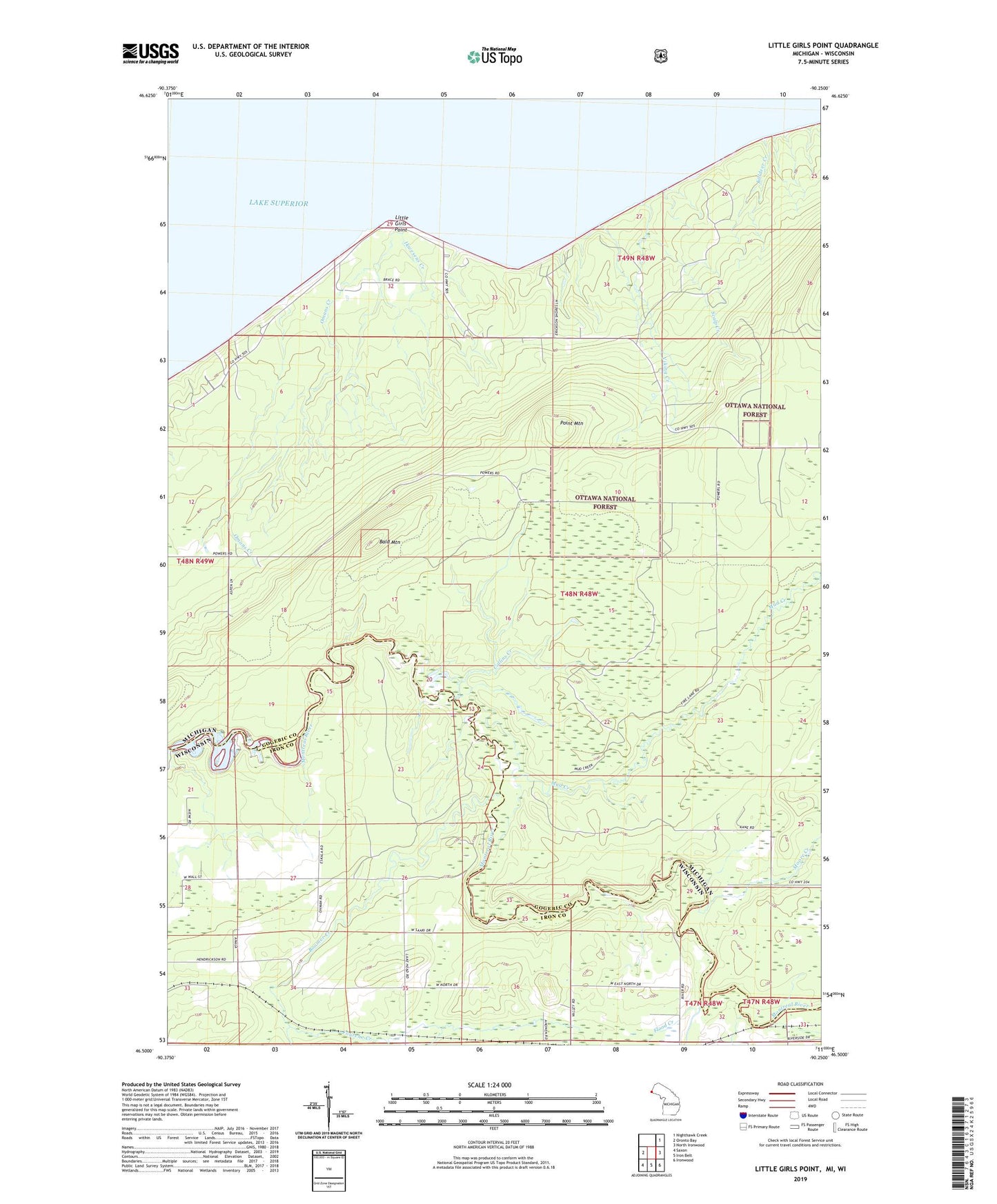
Little Girls Point Michigan US Topo Map
Couldn't load pickup availability
Also explore the Little Girls Point Forest Service Topo of this same quad for updated USFS data
2023 topographic map quadrangle Little Girls Point in the states of Michigan, Wisconsin. Scale: 1:24000. Based on the newly updated USGS 7.5' US Topo map series, this map is in the following counties: Gogebic, Iron. The map contains contour data, water features, and other items you are used to seeing on USGS maps, but also has updated roads and other features. This is the next generation of topographic maps. Printed on high-quality waterproof paper with UV fade-resistant inks.
Quads adjacent to this one:
West: Oronto Bay
Northeast: Nighthawk Creek
East: North Ironwood
Southeast: Ironwood
South: Iron Belt
Southwest: Saxon
Contains the following named places: Bald Mountain, Boomer Creek, Burton Creek, Camp Dejacket, Collins Creek, Flood Creek, Fourche Creek, Historic Indian Burial Grounds, Ikwesens Creek, Immanuel Church, Killdeer Creek, Lake School, Lake Superior Park, Little Girls Point, Little Girls Point Campground, Little Girls Point County Park, Moore Creek, Mud Creek, Omans Boat Service, Omans Creek, Point Mountain, Saxon Falls Flowage, Scalp Creek, Viking Creek, West Fork Montreal River