
MyTopo
Parrish Wisconsin US Topo Map
Couldn't load pickup availability
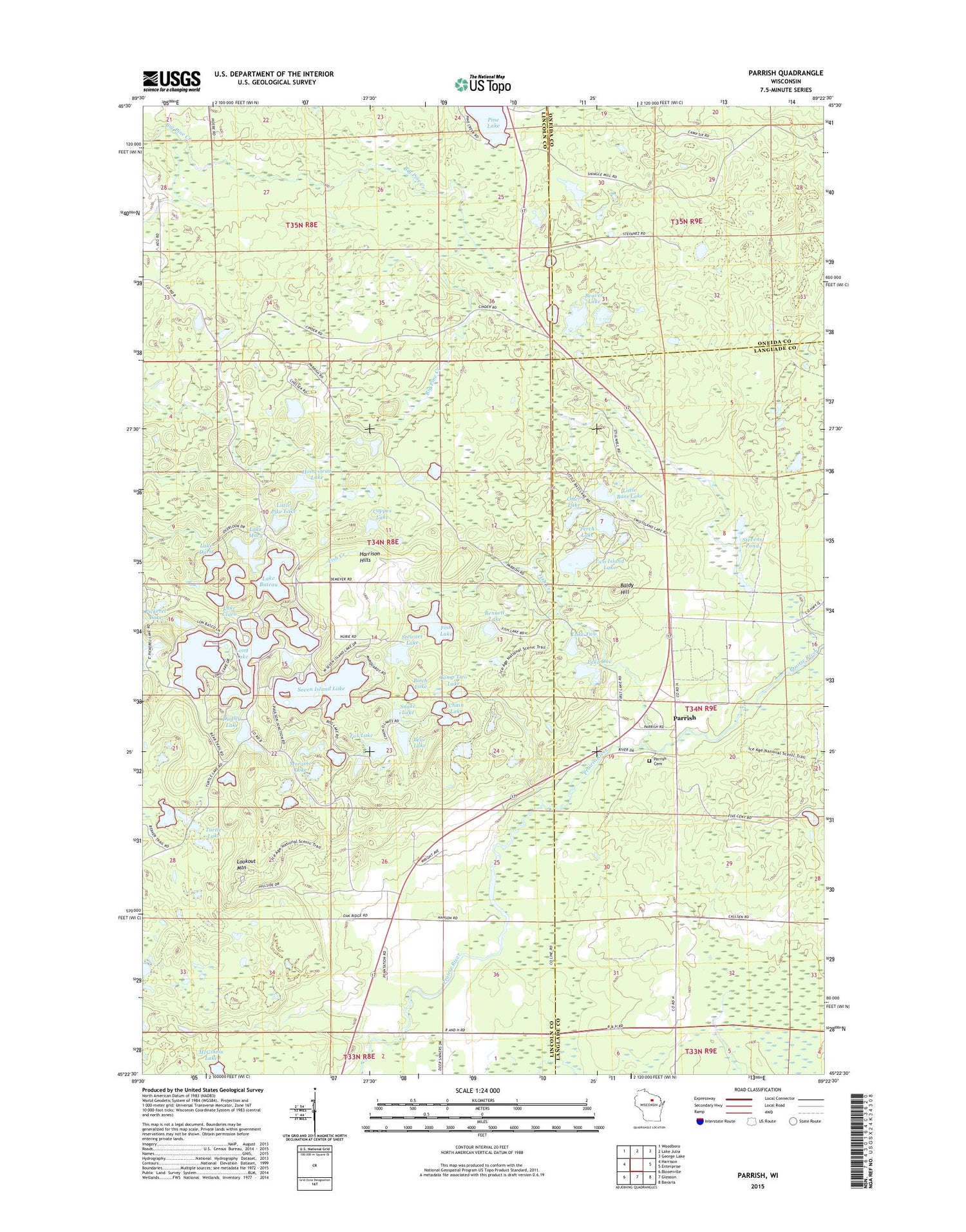
2018 topographic map quadrangle Parrish in the state of Wisconsin. Scale: 1:24000. Based on the newly updated USGS 7.5' US Topo map series, this map is in the following counties: Lincoln, Langlade, Oneida. The map contains contour data, water features, and other items you are used to seeing on USGS maps, but also has updated roads and other features. This is the next generation of topographic maps. Printed on high-quality waterproof paper with UV fade-resistant inks.
Quads adjacent to this one:
West: Harrison
Northwest: Woodboro
North: Lake Julia
Northeast: George Lake
East: Enterprise
Southeast: Bavaria
South: Gleason
Southwest: Bloomville
Contains the following named places: 0.5 Reservoir, Baldy Hill, Bass Lake, Bear Lake, Beaver Lake, Bennett Lake, Birch Lake, Bundy, Callsen School, Camp Two Lake, Chain Lake, Coppes Lake, Dudley Lake, Elm City School, Fish Creek, Fish Lake, Fox Lake, Homestead Lake, Jeffris Junction, Lake Buteau, Lake Clara, Lake Doris, Lake Mary, Lake One, Lake Two, Little Bass Lake, Little Pike Lake, Long Lake, Lookout Mountain, McGinnis Lake, Moraine Lake, Otter Lake, Parrish, Parrish Cemetery, Paulson Junction, Perch Lake, Pinten H373 Dam, Prairie River State Public Hunting and Fishing Area, Seven Island Lake, Snake Lake, Stevens Pond, Stewart Lake, Town of Harrison, Turtle Lake, Two Island Lake, WRHN-FM (Rhinelander)


