MyTopo
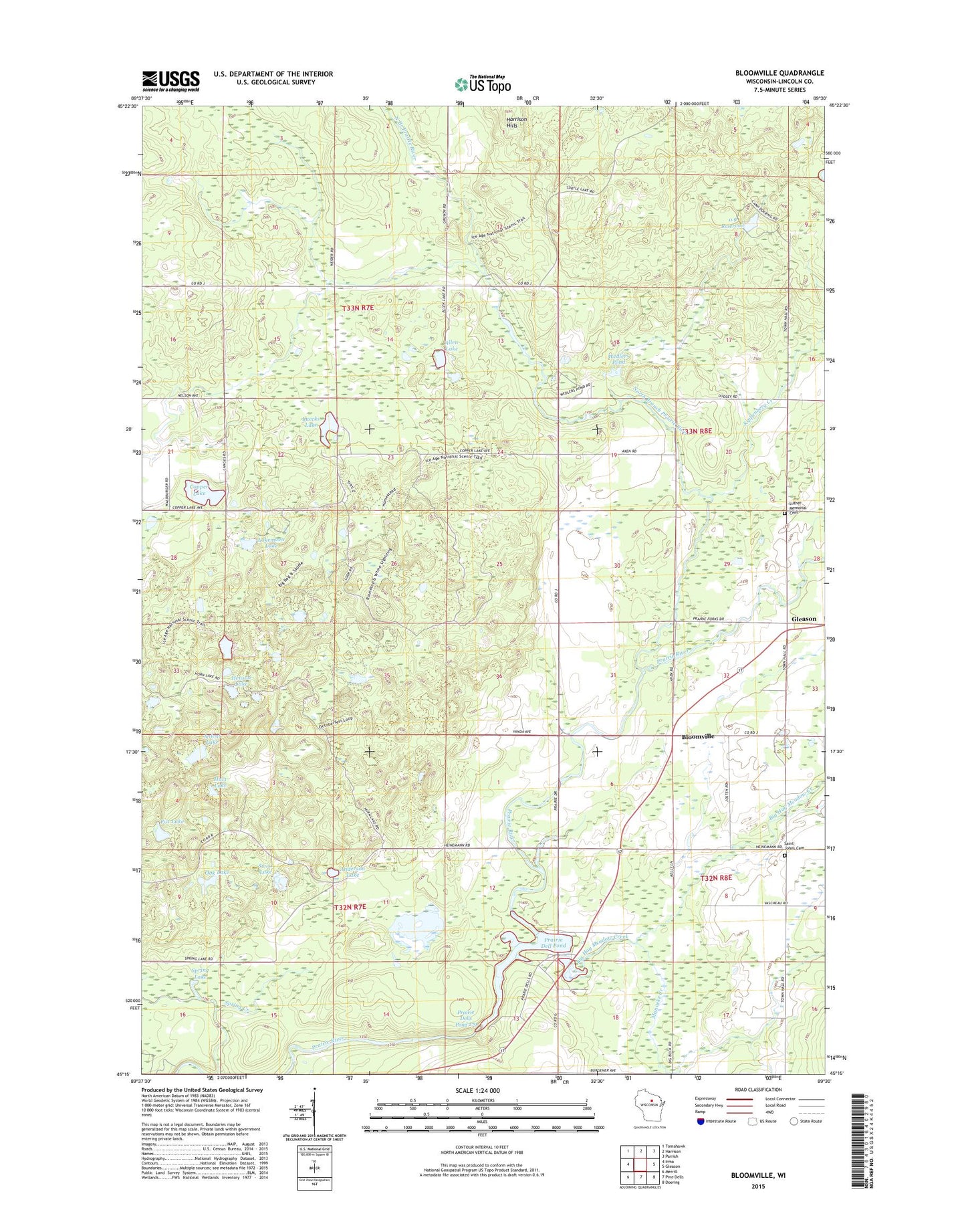
Bloomville Wisconsin US Topo Map
Couldn't load pickup availability
2022 topographic map quadrangle Bloomville in the state of Wisconsin. Scale: 1:24000. Based on the newly updated USGS 7.5' US Topo map series, this map is in the following counties: Lincoln. The map contains contour data, water features, and other items you are used to seeing on USGS maps, but also has updated roads and other features. This is the next generation of topographic maps. Printed on high-quality waterproof paper with UV fade-resistant inks.
Quads adjacent to this one:
West: Irma
Northwest: Tomahawk
North: Harrison
Northeast: Parrish
East: Gleason
Southeast: Doering
South: Pine Dells
Southwest: Merrill
This map covers the same area as the classic USGS quad with code o45089c5.
Contains the following named places: 0.9 Reservoir, Allen Lake, Anderson Lake, Anient Lake, Axen Lake School, Big Hay Meadow Creek, Bloomville, Bloomville Church, Copper Lake, Doering E12.129 Dam, Drew School, Fox Lake, Hart Lake, Hay Meadow County Park, Henson Lake, Kings Springs State Public Fishery Area, Kippenberg Creek, Lincoln County Landfill, Lokemoen Lake, Luecks Lake, Luther Memorial Cemetery, Manacke Creek, Maple Grove School, North Branch Prairie River, Oak Lake, Pays Springs State Public Fishery Area, Prairie Dell County Park, Prairie Dell Dam, Prairie Dell Pond, Prairie Dells Dam, Prairie Dells Pond 179, Saint John Baptist Catholic Cemetery, Spring Lake, Spring Lake State Public Hunting and Fishing Area, Swiss Lake, Town of Birch, Town of Schley, Wedlers Pond