MyTopo
Rosendale Wisconsin US Topo Map
Couldn't load pickup availability
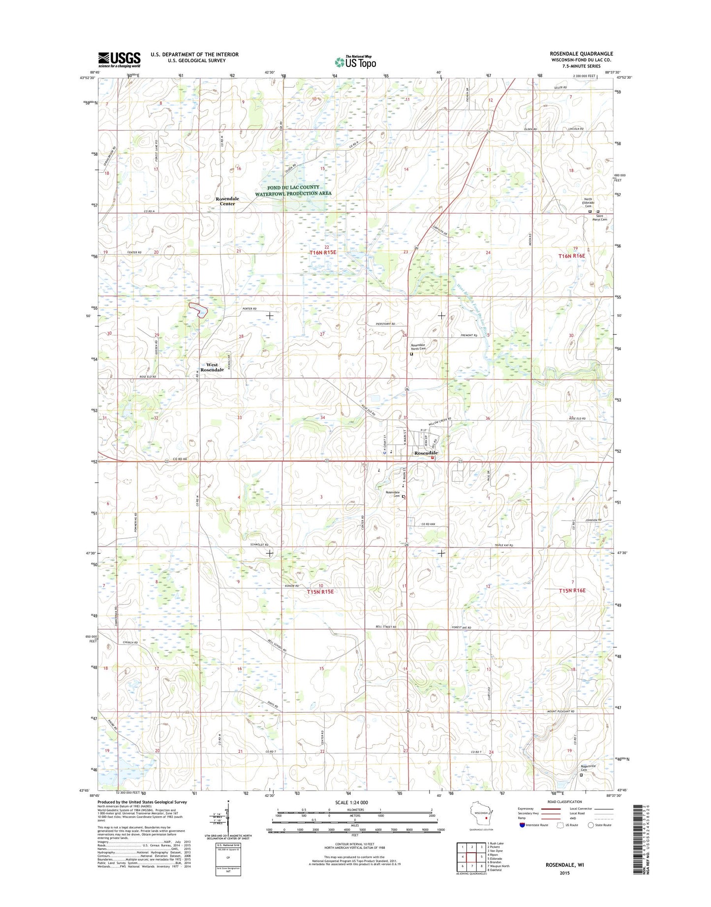
2022 topographic map quadrangle Rosendale in the state of Wisconsin. Scale: 1:24000. Based on the newly updated USGS 7.5' US Topo map series, this map is in the following counties: Fond du Lac. The map contains contour data, water features, and other items you are used to seeing on USGS maps, but also has updated roads and other features. This is the next generation of topographic maps. Printed on high-quality waterproof paper with UV fade-resistant inks.
Quads adjacent to this one:
West: Ripon
Northwest: Rush Lake
North: Pickett
Northeast: Van Dyne
East: Eldorado
Southeast: Oakfield
South: Waupun North
Southwest: Brandon
This map covers the same area as the classic USGS quad with code o43088g6.
Contains the following named places: Bell School, Coehoorn Farms, Coles Corner School, Dodd School, Emerson School, Fremont School, Goeden Farm, Guenzel Farm, Laconia High School, North Eldorado Cemetery, North Rosendale Cemetery, Orvis Farms, Perry School, Pinch Farms, Rogersville Cemetery, Rose - Eld Farms, Roselle Farms, Rosendale, Rosendale Cemetery, Rosendale Center, Rosendale Fire Department, Rosendale Intermediate School, Rosendale Police Department, Rosendale Post Office, Rosendale Primary School, Rosendale Wastewater Treatment Facility, Royal Crest Farms, Saint Marys Cemetery, Saint Marys Church, Shafer's Acres, Stoney Hill Farms, Town of Rosendale, Town of Springvale, Townline School, Village of Rosendale, West Rosendale, William N Taylor Park, WYUR-FM (Ripon), ZIP Code: 54974