MyTopo
Morrison Wisconsin US Topo Map
Couldn't load pickup availability
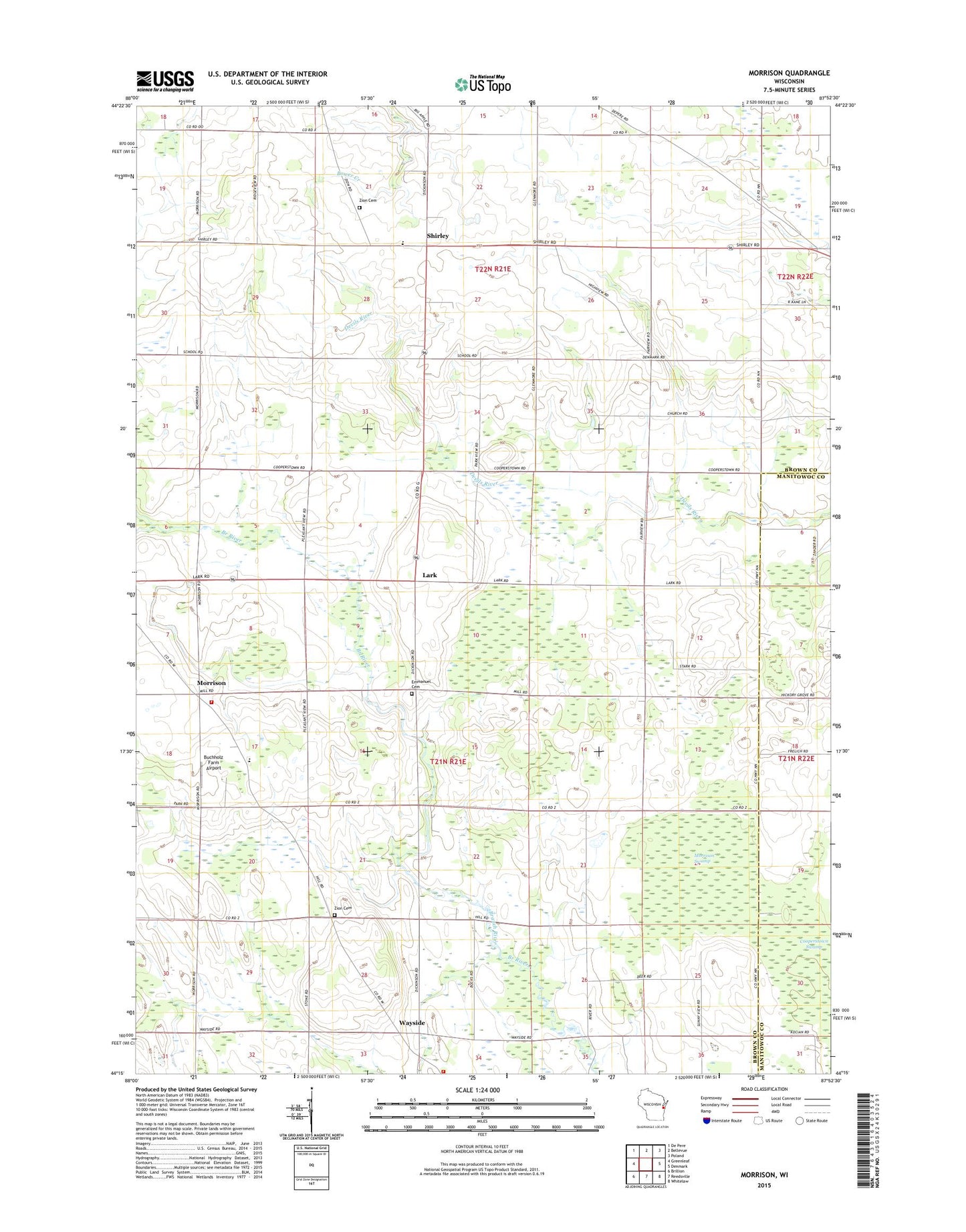
2022 topographic map quadrangle Morrison in the state of Wisconsin. Scale: 1:24000. Based on the newly updated USGS 7.5' US Topo map series, this map is in the following counties: Brown, Manitowoc. The map contains contour data, water features, and other items you are used to seeing on USGS maps, but also has updated roads and other features. This is the next generation of topographic maps. Printed on high-quality waterproof paper with UV fade-resistant inks.
Quads adjacent to this one:
West: Greenleaf
Northwest: De Pere
North: Bellevue
Northeast: Poland
East: Denmark
Southeast: Whitelaw
South: Reedsville
Southwest: Brillion
This map covers the same area as the classic USGS quad with code o44087c8.
Contains the following named places: Buchholz Farm Airport, Conrod School, East Wayside School, Emmanuel Cemetery, Emmanuel Church, Glenmore School, Hauser School, Hebels Corners, Holy Trinity Church, Immanuel Evangelical Lutheran School of Shirley, Kapinos Pit, Lark, Lark School, Morrison, Morrison Swamp, Morrison Volunteer Fire Department, Morrison Zion Lutheran School, Ness Dairy, Otto-Gibbons Airport, Pelishek Corners, Saint Mary Church, Saint Marys Church, Shirley, Shirley School, Stark School, Town of Glenmore, Town of Morrison, WAPL-FM (Appleton), Way-Morr County Park, Wayside, Wayside Dairy Farm, Wayside School, Wayside Volunteer Fire Department, WGBA-TV (Green Bay), WXGZ-TV (Appleton), Zion Cemetery, Zion Church