MyTopo
Reedsville Wisconsin US Topo Map
Couldn't load pickup availability
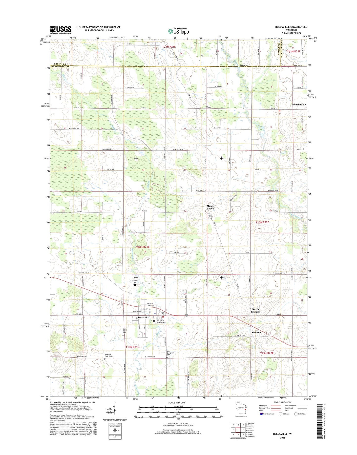
2022 topographic map quadrangle Reedsville in the state of Wisconsin. Scale: 1:24000. Based on the newly updated USGS 7.5' US Topo map series, this map is in the following counties: Manitowoc, Brown. The map contains contour data, water features, and other items you are used to seeing on USGS maps, but also has updated roads and other features. This is the next generation of topographic maps. Printed on high-quality waterproof paper with UV fade-resistant inks.
Quads adjacent to this one:
West: Brillion
Northwest: Greenleaf
North: Morrison
Northeast: Denmark
East: Whitelaw
Southeast: Clarks Mills
South: Valders
Southwest: Potter
This map covers the same area as the classic USGS quad with code o44087b8.
Contains the following named places: Baroun Century Farm, Brookside School, County Line Dairy Farm, Fenlon Farm, Frieden Cemetery, Fritsch Lane Dairy, Grimms, Hamp Haven Farms, Immanuel Church, Kocian Dairy, L and S Farms, Loppnow Dairy Farm, M and L Farms, Maetz Farms, Majestic Acres Dairy Farm, Maple Grove, Maple Rock School, Marquette School, Menchalville, Menchalville Fire Department, North Grimms, Ohearn Dairy Farm, Reeds Vu Dairy Farm, Reedsville, Reedsville Elementary School, Reedsville Fire Department, Reedsville High School, Reedsville Middle School, Reedsville Police Department, Reedsville Post Office, Rockland E U B Cemetery, Russlers Ranch, Saint John - Saint James Lutheran Cemetery, Saint John - Saint James Lutheran School, Saint John-Saint James Lutheran Church, Saint Mary-Patrick School, Saint Marys and Saint Patricks Church, Saint Mary's Cemetery, Sheahan Farms, Town of Maple Grove, Village of Reedsville, Welsh Farm, Ziemer Dairy Farm, Zion Evergreen Cemetery, Zion Lutheran School of Wayside, Zion United Methodist Church, ZIP Code: 54230