MyTopo
Pulaski Wisconsin US Topo Map
Couldn't load pickup availability
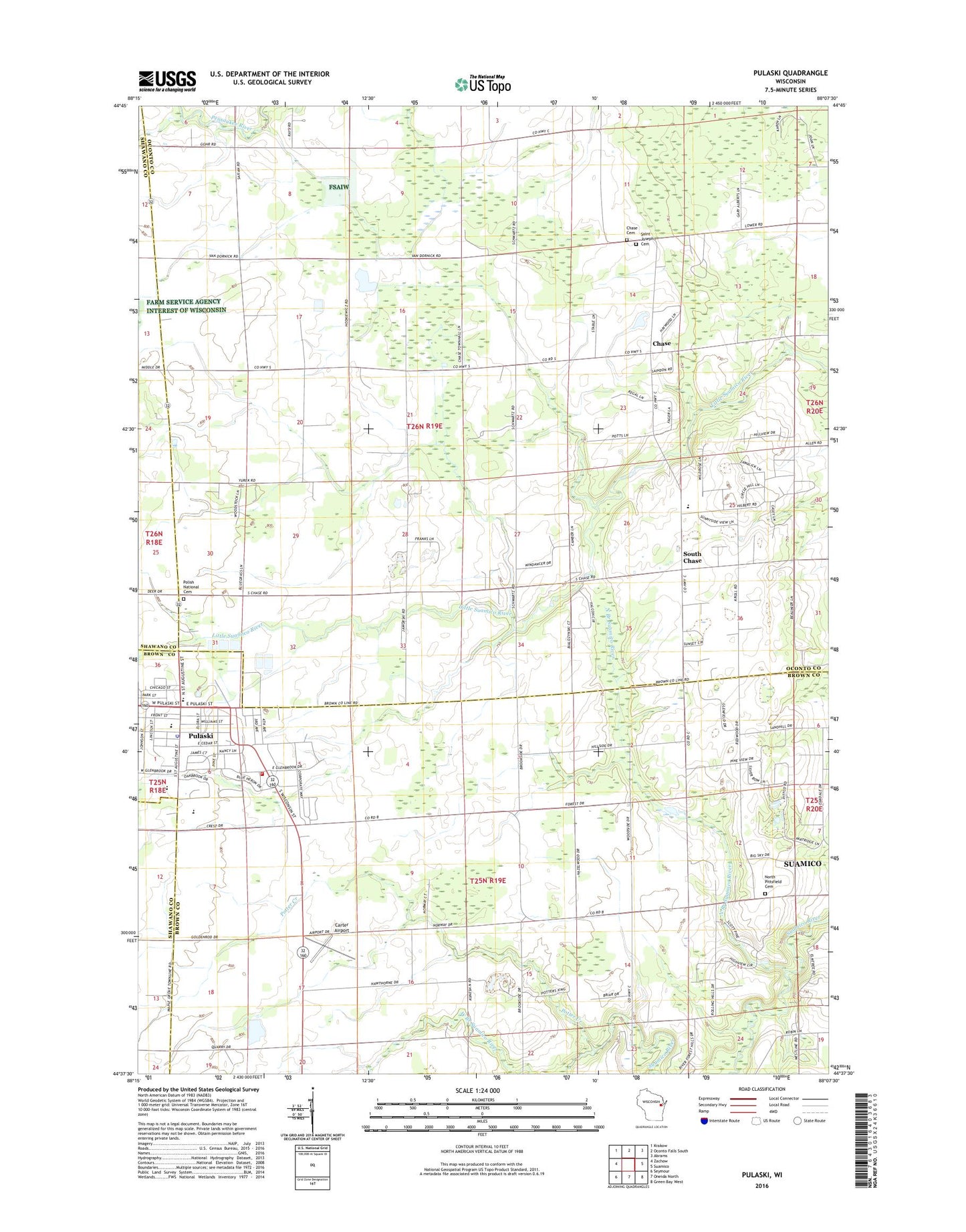
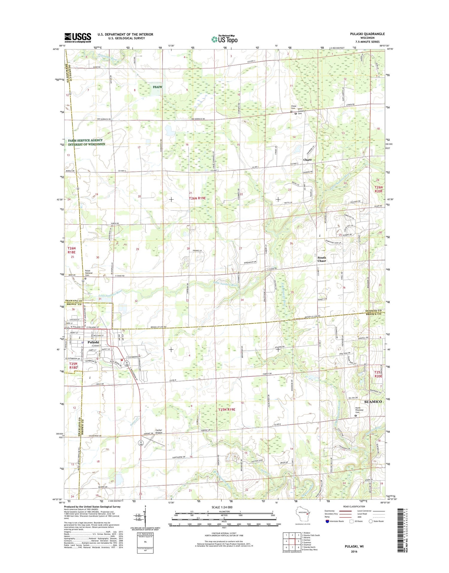
2018 topographic map quadrangle Pulaski in the state of Wisconsin. Scale: 1:24000. Based on the newly updated USGS 7.5' US Topo map series, this map is in the following counties: Oconto, Brown, Shawano. The map contains contour data, water features, and other items you are used to seeing on USGS maps, but also has updated roads and other features. This is the next generation of topographic maps. Printed on high-quality waterproof paper with UV fade-resistant inks.
Quads adjacent to this one:
West: Zachow
Northwest: Krakow
North: Oconto Falls South
Northeast: Abrams
East: Suamico
Southeast: Green Bay West
South: Oneida North
Southwest: Seymour
Contains the following named places: Assumption of the Blessed Virgin Mary School, Brown County Library Pulaski Branch Library, Camelot Terrace, Carter Airport, Chase, Chase Cemetery, Chase Quarry, Franciscan Monastery, Glenbrook Elementary School, Good Cheer School, New Paramedic Rescue, North Branch Suamico River, North Pittsfield Cemetery, North Pittsfield School, Pittsfield Church, Pleasant View Mobile Home Park, Polish National Cemetery, Potter Creek, Pulaski, Pulaski Community Middle School, Pulaski High School, Pulaski Police Department, Pulaski Post Office, Pulaski Tri - County Fire Department, Saint Joseph Cemetery, Saint Joseph Church, South Chase, Sunnyside Elementary School, Sunnyside School, Town of Chase, Town of Pittsfield, Village of Pulaski, WQLH-FM (Green Bay), Zion Church