MyTopo
Oconto Falls South Wisconsin US Topo Map
Couldn't load pickup availability
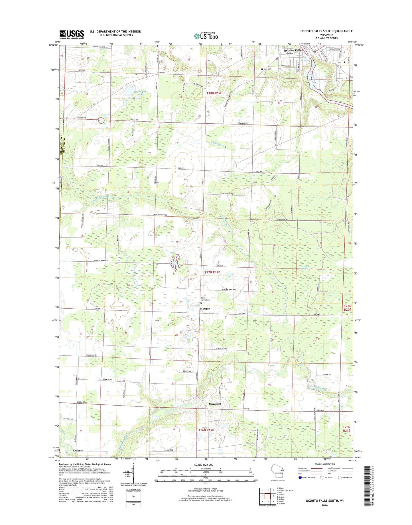
2022 topographic map quadrangle Oconto Falls South in the state of Wisconsin. Scale: 1:24000. Based on the newly updated USGS 7.5' US Topo map series, this map is in the following counties: Oconto, Shawano. The map contains contour data, water features, and other items you are used to seeing on USGS maps, but also has updated roads and other features. This is the next generation of topographic maps. Printed on high-quality waterproof paper with UV fade-resistant inks.
Quads adjacent to this one:
West: Krakow
Northwest: Gillett
North: Oconto Falls North
Northeast: Lena
East: Abrams
Southeast: Suamico
South: Pulaski
Southwest: Zachow
This map covers the same area as the classic USGS quad with code o44088g2.
Contains the following named places: 731 Reservoir, Central Morgan School, City of Oconto Falls, Community Memorial Hospital Heliport, Coopman Creek, Degantown School, Delzer Lake, Dombroski Lake, Falls Alternative Learning Site, First Methodist Church, Flats Recreation Area, Flowing Spring School, Grace Lutheran Church, HSHS Saint Clare Memorial Hospital, Jefferson School, Lincoln School, Lower Oconto Falls 1857c195 Dam, Morgan, Morgan Marsh, New Path School, North Branch Pensaukee River, North Morgan School, Oconto Falls, Oconto Falls Area Ambulance, Oconto Falls Elementary School, Oconto Falls High School, Oconto Falls Hospital, Oconto Falls Wastewater Treatment Plant, Saint Johns Cemetery, Saint Johns Church, Saint Pauls Evangelical Lutheran Church, Sampson, South Morgan School, Town of Morgan, Volk Cemetery, Volk School, Washington Middle School, Zion Lutheran Church, ZIP Code: 54154