MyTopo
Abrams Wisconsin US Topo Map
Couldn't load pickup availability
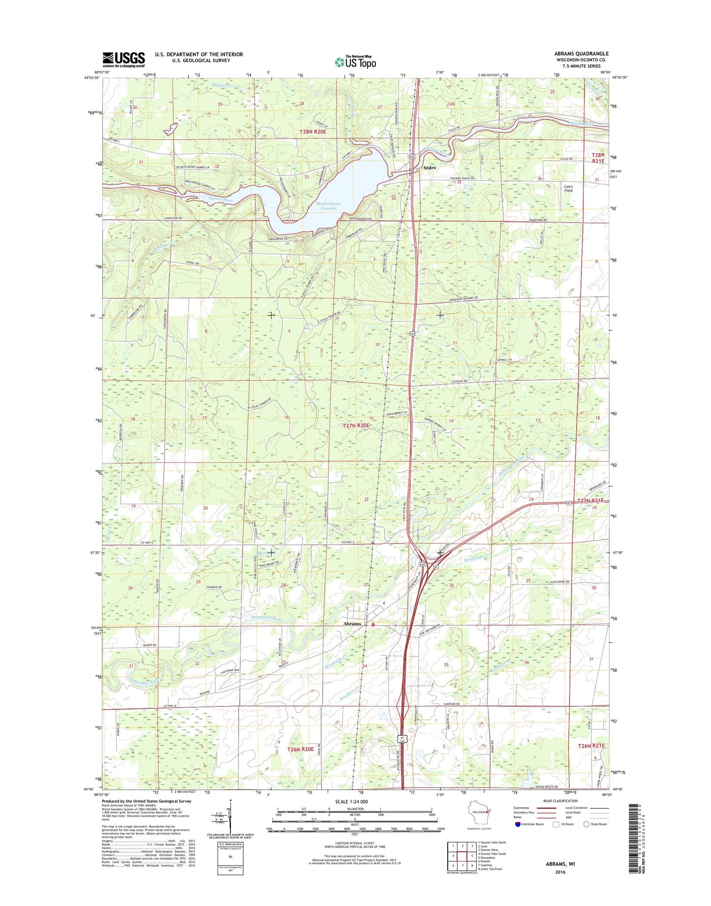
2022 topographic map quadrangle Abrams in the state of Wisconsin. Scale: 1:24000. Based on the newly updated USGS 7.5' US Topo map series, this map is in the following counties: Oconto. The map contains contour data, water features, and other items you are used to seeing on USGS maps, but also has updated roads and other features. This is the next generation of topographic maps. Printed on high-quality waterproof paper with UV fade-resistant inks.
Quads adjacent to this one:
West: Oconto Falls South
Northwest: Oconto Falls North
North: Lena
Northeast: Oconto West
East: Pensaukee
Southeast: Little Tail Point
South: Suamico
Southwest: Pulaski
This map covers the same area as the classic USGS quad with code o44088g1.
Contains the following named places: Abrams, Abrams Census Designated Place, Abrams Elementary School, Abrams Fire Department, Abrams Post Office, Brehmer Creek, Cain's Field, Machickanee Flowage, Machickanee Flowage 770, Pioneer Memorial County Park, Sandalwood Country Club, Splinter Creek, Spring Creek, Stiles, Stiles 2WP550 Dam, Stiles Lookout Tower, Town of Abrams, ZIP Code: 54101