MyTopo
Roberts Wisconsin US Topo Map
Couldn't load pickup availability
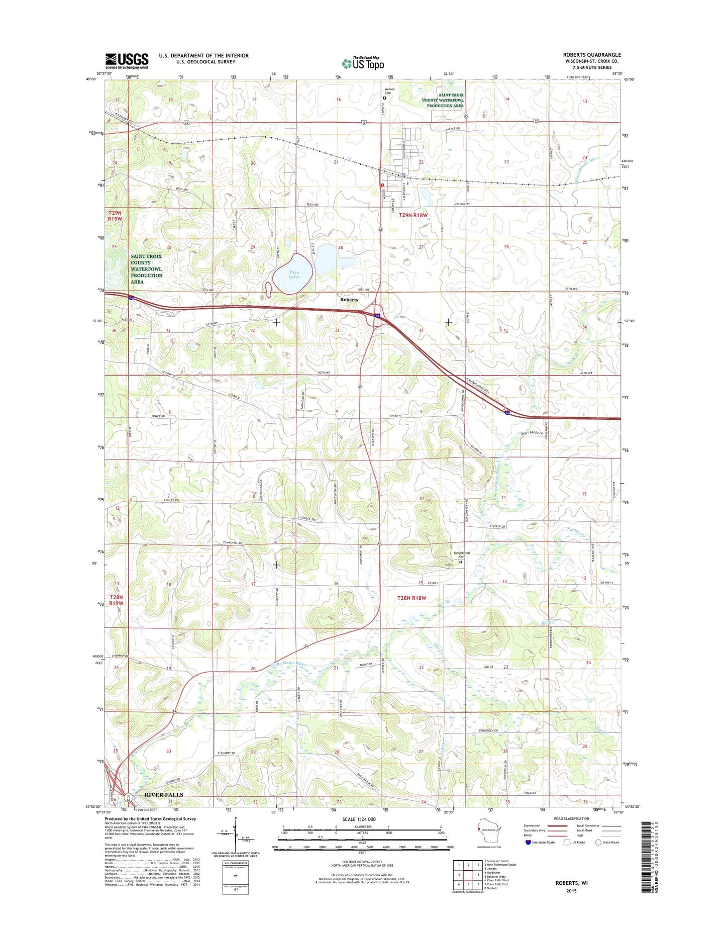
2018 topographic map quadrangle Roberts in the state of Wisconsin. Scale: 1:24000. Based on the newly updated USGS 7.5' US Topo map series, this map is in the following counties: St. Croix. The map contains contour data, water features, and other items you are used to seeing on USGS maps, but also has updated roads and other features. This is the next generation of topographic maps. Printed on high-quality waterproof paper with UV fade-resistant inks.
Quads adjacent to this one:
West: Northline
Northwest: Somerset South
North: New Richmond South
Northeast: Jewett
East: Baldwin West
Southeast: Martell
South: River Falls East
Southwest: River Falls West
Contains the following named places: Elm Lawn School, Hillside School, Kelly Creek, Kinnickinnic Cemetery, Kinnickinnic Church, Kinnickinnic River State Fishery Area, Kinnickinnic Townhall, Monument School, Nineteen Hundred School, Nye Creek, Oak Valley School, Parker Creek, Roberts, Roberts Police Department, Roberts Post Office, Roberts Warren Fire and Rescue Department, Roberts Wastewater Treatment Facility, Saint Croix Central Elementary School, South Branch Kinnickinnic River, Ted Creek, Town of Kinnickinnic, Town of Warren, Trout Brook School, Twin Lakes, Twin Lakes State Access Point, Village of Roberts, Warren Cemetery, ZIP Code: 54023