MyTopo
Round Bluff Wisconsin US Topo Map
Couldn't load pickup availability
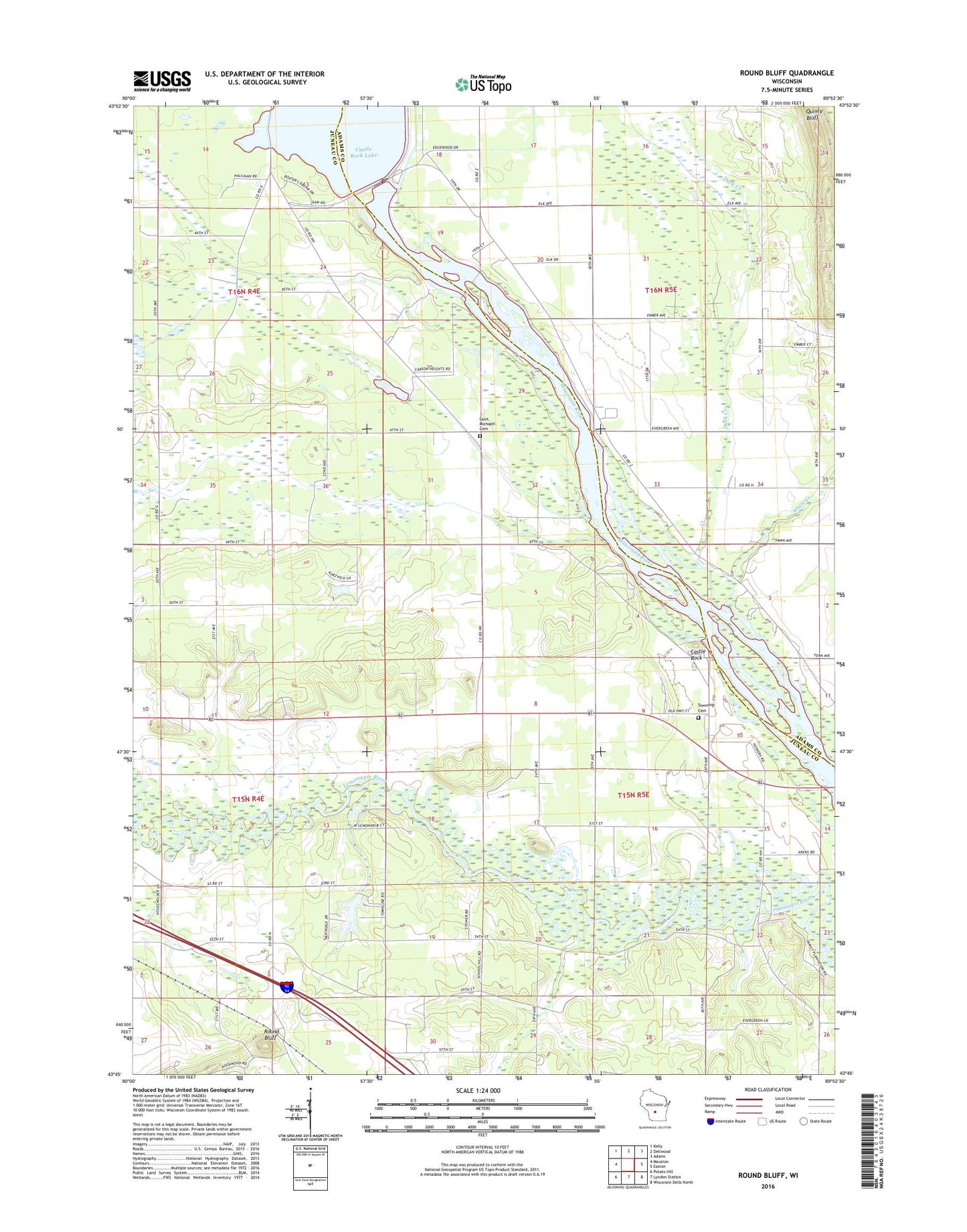
2018 topographic map quadrangle Round Bluff in the state of Wisconsin. Scale: 1:24000. Based on the newly updated USGS 7.5' US Topo map series, this map is in the following counties: Juneau, Adams. The map contains contour data, water features, and other items you are used to seeing on USGS maps, but also has updated roads and other features. This is the next generation of topographic maps. Printed on high-quality waterproof paper with UV fade-resistant inks.
Quads adjacent to this one:
West: Mauston
Northwest: Kelly
North: Dellwood
Northeast: Adams
East: Easton
Southeast: Wisconsin Dells North
South: Lyndon Station
Southwest: Potato Hill
Contains the following named places: Castle Rock, Castle Rock 2WP724 Dam, Duck Creek, Hamm Dam, Oak School, Petenwell 2WP722 Dam, Pokorney 3WR273 Dam, Quincy Bluff, Round Bluff, Saint Johns Church, Saint Michaels Cemetery, Saint Michaels Church, Sevenmile Creek, Town of Marion, Town of Marion Cemetery, White Creek, Woodside Ranch