MyTopo
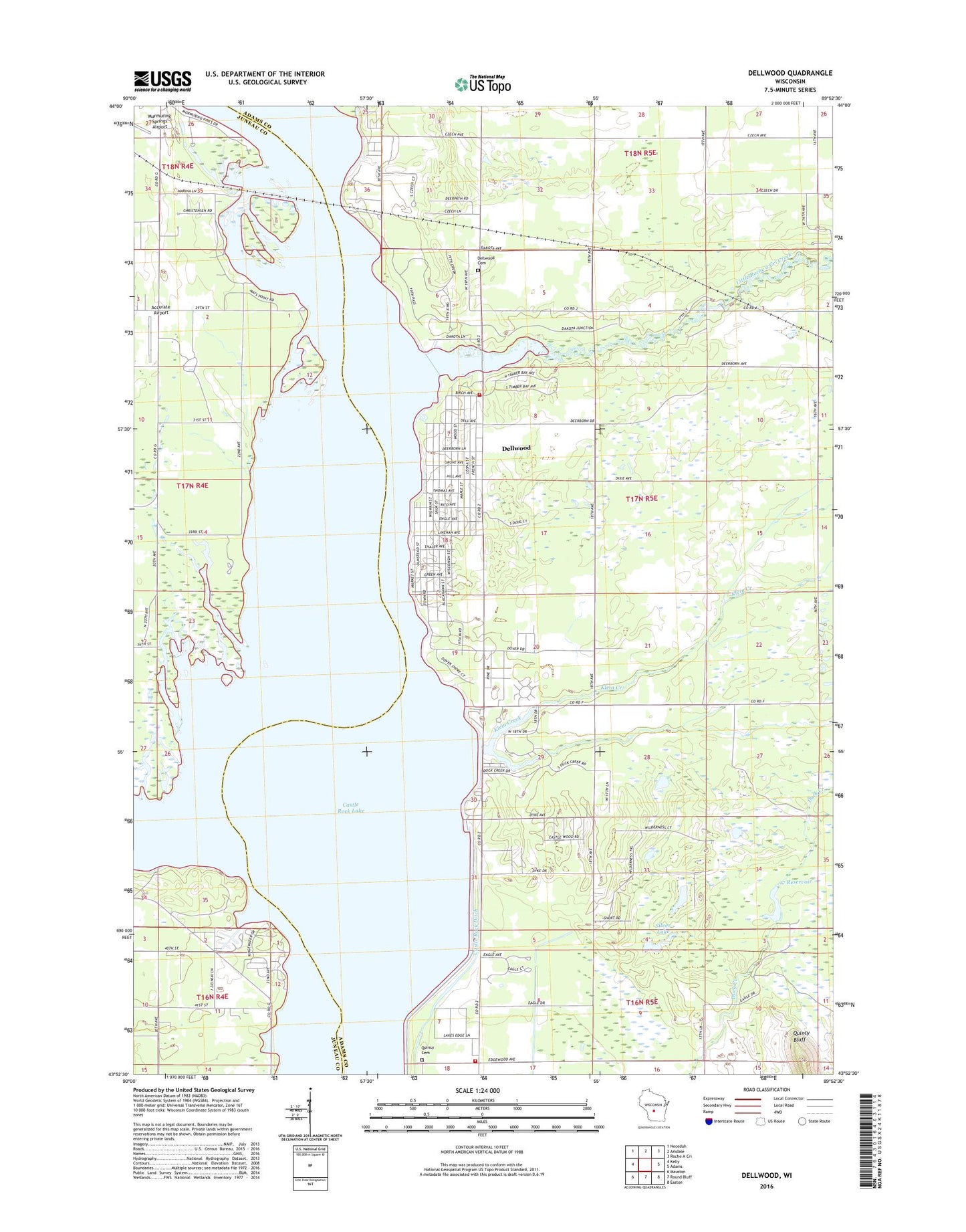
Dellwood Wisconsin US Topo Map
Couldn't load pickup availability
2022 topographic map quadrangle Dellwood in the state of Wisconsin. Scale: 1:24000. Based on the newly updated USGS 7.5' US Topo map series, this map is in the following counties: Adams, Juneau. The map contains contour data, water features, and other items you are used to seeing on USGS maps, but also has updated roads and other features. This is the next generation of topographic maps. Printed on high-quality waterproof paper with UV fade-resistant inks.
Quads adjacent to this one:
West: Kelly
Northwest: Necedah
North: Arkdale
Northeast: Roche A Cri
East: Adams
Southeast: Easton
South: Round Bluff
Southwest: Mauston
This map covers the same area as the classic USGS quad with code o43089h8.
Contains the following named places: 17 Reservoir, Accurate Airport, Buckhorn Barrens State Natural Area, Buckhorn State Park, Buckhorn State Wildlife Area, Castle Rock County Park, Castle Rock Ditch, Castle Rock Lake, Dellaire Landing Strip, Dellwood, Dellwood Cemetery, Dellwood Census Designated Place, Klein Creek, Little Roche a Cri Creek, Murmuring Springs Airport, Our Lady of the Lake Catholic Church, Quincy, Quincy Cemetery, Quincy Volunteer Fire Department, Quincy Volunteer Fire Department Station 1, Schwahn 3NC78806 Dam, Silver Lake, Sohlberg Silver Lake State Natural Area, Town of Quincy, Yellow River