MyTopo
Scovils Lake Wisconsin US Topo Map
Couldn't load pickup availability
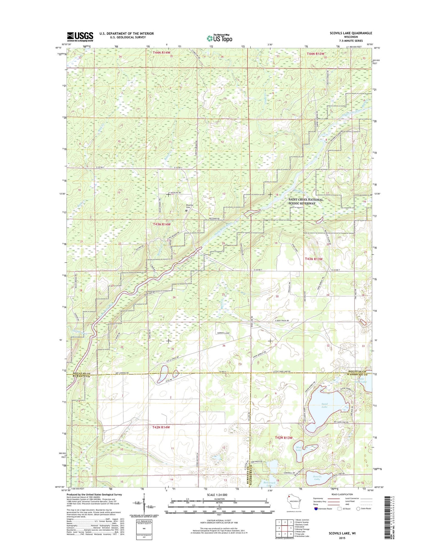
2019 topographic map quadrangle Scovils Lake in the state of Wisconsin. Scale: 1:24000. Based on the newly updated USGS 7.5' US Topo map series, this map is in the following counties: Douglas, Burnett, Washburn. The map contains contour data, water features, and other items you are used to seeing on USGS maps, but also has updated roads and other features. This is the next generation of topographic maps. Printed on high-quality waterproof paper with UV fade-resistant inks.
Quads adjacent to this one:
West: Dairyland
Northwest: Moose Junction
North: Empire Swamp
Northeast: Buckety Creek
East: Minong Flowage
Southeast: Horseshoe Lake
South: Frog Lake
Southwest: Webb Lake
Contains the following named places: Bacon Creek, Beartrack Lake, Beaver Creek, Buckley Creek, Coppermine Dam, Crotte Creek, Little Sand Lake, Louise Park, Mud Lake, Riverhill Cemetery, Sand Lake, Schoen Park, Scovils Lake, Sheosh Creek, Thompson Creek