MyTopo
Siren West Wisconsin US Topo Map
Couldn't load pickup availability
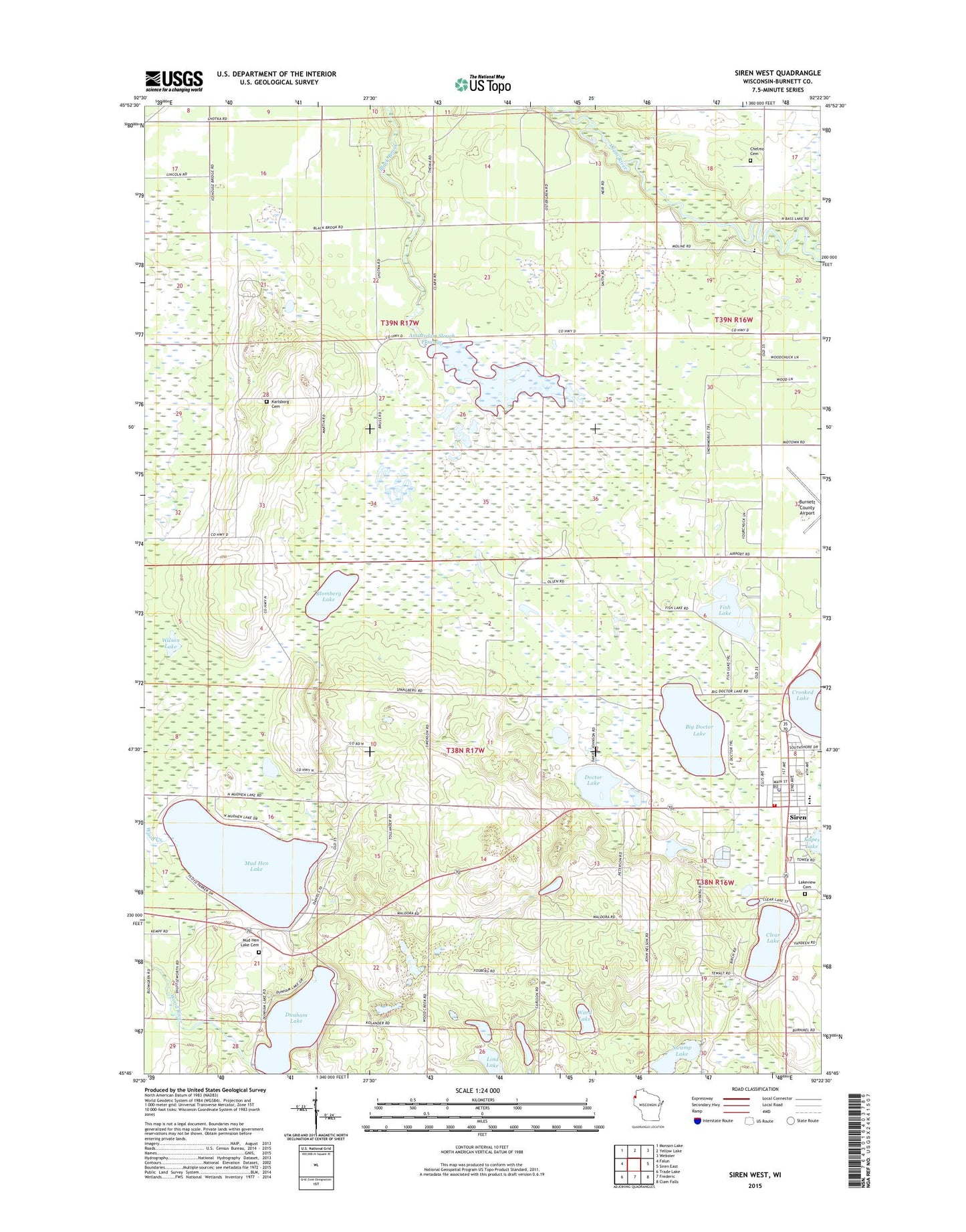
2018 topographic map quadrangle Siren West in the state of Wisconsin. Scale: 1:24000. Based on the newly updated USGS 7.5' US Topo map series, this map is in the following counties: Burnett. The map contains contour data, water features, and other items you are used to seeing on USGS maps, but also has updated roads and other features. This is the next generation of topographic maps. Printed on high-quality waterproof paper with UV fade-resistant inks.
Quads adjacent to this one:
West: Falun
Northwest: Monson Lake
North: Yellow Lake
Northeast: Webster
East: Siren East
Southeast: Clam Falls
South: Frederic
Southwest: Trade Lake
Contains the following named places: Amsterdam Slough Flowage, Amsterdam Slough G12 90 Dam, Amsterdam Sloughs State Public Hunting Grounds, Bethany Lutheran Church, Big Doctor Lake, Black Brook School, Blomberg Lake, Blomberg Lake State Natural Area, Chelmo Cemetery, Clear Lake, Crooked Lake, Doctor Lake, Dunham Lake, Fish Lake, Kapes Lake, Karlsborg Cemetery, Karlsborg Quarry and Pit, Karlsborg School, Lakeview Cemetery, Lind Lake, Mud Hen Lake, Northwest Passage School, Siren, Siren Assembly of God Church, Siren Covenant Church, Siren Elementary School, Siren High School, Siren Lookout Tower, Siren Police Department, Siren Post Office, Siren United Methodist Church, Siren Volunteer Fire Department, Swamp Lake, Town of Daniels, Town of Lincoln, Village of Siren, Ward Lake, Wilson Lake, ZIP Code: 54872