MyTopo
Springbrook Wisconsin US Topo Map
Couldn't load pickup availability
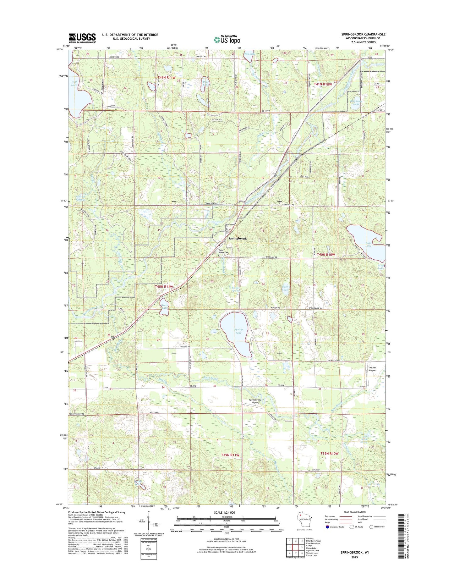
2019 topographic map quadrangle Springbrook in the state of Wisconsin. Scale: 1:24000. Based on the newly updated USGS 7.5' US Topo map series, this map is in the following counties: Washburn. The map contains contour data, water features, and other items you are used to seeing on USGS maps, but also has updated roads and other features. This is the next generation of topographic maps. Printed on high-quality waterproof paper with UV fade-resistant inks.
Quads adjacent to this one:
West: Trego
Northwest: Minong
North: Stanberry West
Northeast: Stanberry East
East: Bean Lake
Southeast: Stone Lake
South: Potato Lake
Southwest: Spooner Lake
Contains the following named places: Bass Lake, Bean Brook, Bean Brook Spring, Brinkman Lake, Chippanazie Creek, Deep Lake, Deer Lake, Fairview School, Godfrey Creek, Green Lake, Gull Creek, Gull Creek Springs, Gull Lake Townhall, Hay Creek, Lucky Lake, Mackay Creek, Mackay Valley Church, Mackay Valley School, Saint Lukes Cemetery, Savage Springs, South Fork Bean Brook, Spring Brook, Spring Creek, Spring Lake, Springbrook, Springbrook Airport, Springbrook Census Designated Place, Springbrook Post Office, Stanbery School, Town of Springbrook, Tranus Creek, Willie's Airport, ZIP Code: 54875