MyTopo
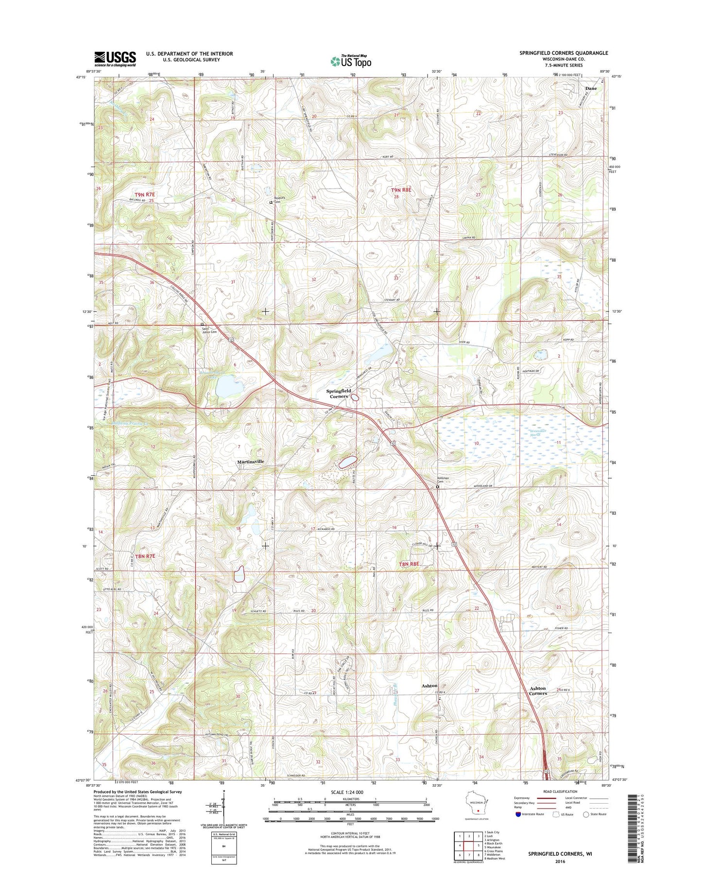
Springfield Corners Wisconsin US Topo Map
Couldn't load pickup availability
2018 topographic map quadrangle Springfield Corners in the state of Wisconsin. Scale: 1:24000. Based on the newly updated USGS 7.5' US Topo map series, this map is in the following counties: Dane. The map contains contour data, water features, and other items you are used to seeing on USGS maps, but also has updated roads and other features. This is the next generation of topographic maps. Printed on high-quality waterproof paper with UV fade-resistant inks.
Quads adjacent to this one:
West: Black Earth
Northwest: Sauk City
North: Lodi
Northeast: Arlington
East: Waunakee
Southeast: Madison West
South: Middleton
Southwest: Cross Plains
Contains the following named places: Ashton, Ashton Corners, Barbian Pond, Bicklers Apple Farm, Blessed Trinity Catholic School, Brandenburg Lake, Camp Brandenburg, Carl Buechner Pond, Dahmen Pond, Dane Cemetery, Diedrich Pond, Dons Mobile Manor, Empire Prairies State Natural Area, Kalscheur Pond, Koch Prairie, Kohlman Cemetery, Louis Buechner Pond, Lutheran Hill, Martinsville, Meier Pond, Saint Johns Church, Saint John's Lutheran Cemetery, Saint Martins Catholic Church, Saint Martin's Cemetery, Saint Michael's Cemetery, Saint Peter Catholic School, Saint Peters Catholic Church, Saint Peter's Cemetery, Springfield Corners, Springfield Pond, Springfield School, Town of Springfield, Truehl Cemetery, Wagner Dairy Farm, Waunakee Marsh, Waunakee Marsh State Wildlife Management Area, WMLI-FM (Sauk City), Ziegler Dairy Farms, Ziegler Quarry, ZIP Code: 53529