MyTopo
Arlington Wisconsin US Topo Map
Couldn't load pickup availability
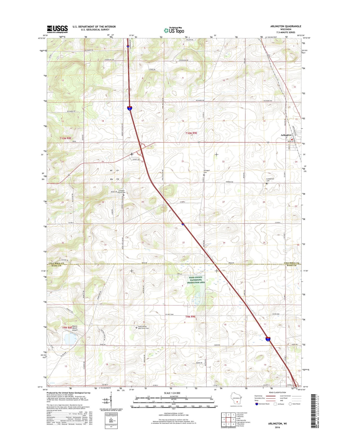
2022 topographic map quadrangle Arlington in the state of Wisconsin. Scale: 1:24000. Based on the newly updated USGS 7.5' US Topo map series, this map is in the following counties: Columbia, Dane. The map contains contour data, water features, and other items you are used to seeing on USGS maps, but also has updated roads and other features. This is the next generation of topographic maps. Printed on high-quality waterproof paper with UV fade-resistant inks.
Quads adjacent to this one:
West: Lodi
Northwest: Durwards Glen
North: Poynette
Northeast: Wyocena
East: Morrisonville
Southeast: De Forest
South: Waunakee
Southwest: Springfield Corners
This map covers the same area as the classic USGS quad with code o43089c4.
Contains the following named places: Arlington, Arlington Cemetery, Arlington Elementary School, Arlington Evangelical Cemetery, Arlington Fire Department, Arlington Post Office, Arlington Prairie Cemetery, Arlington Prairie Church, Arlington Sewage Treatment Plant, Arlington United Methodist Church, Dane Immanuel Cemetery, Dane Post Office, Eberle Ranch Airport, One Hundred Mile Grove Cemetery, Poynette Quarry, Saint Peters Lutheran Church, Town of Arlington, Town of Vienna, WIBU-AM (Poynette)