MyTopo
Lodi Wisconsin US Topo Map
Couldn't load pickup availability
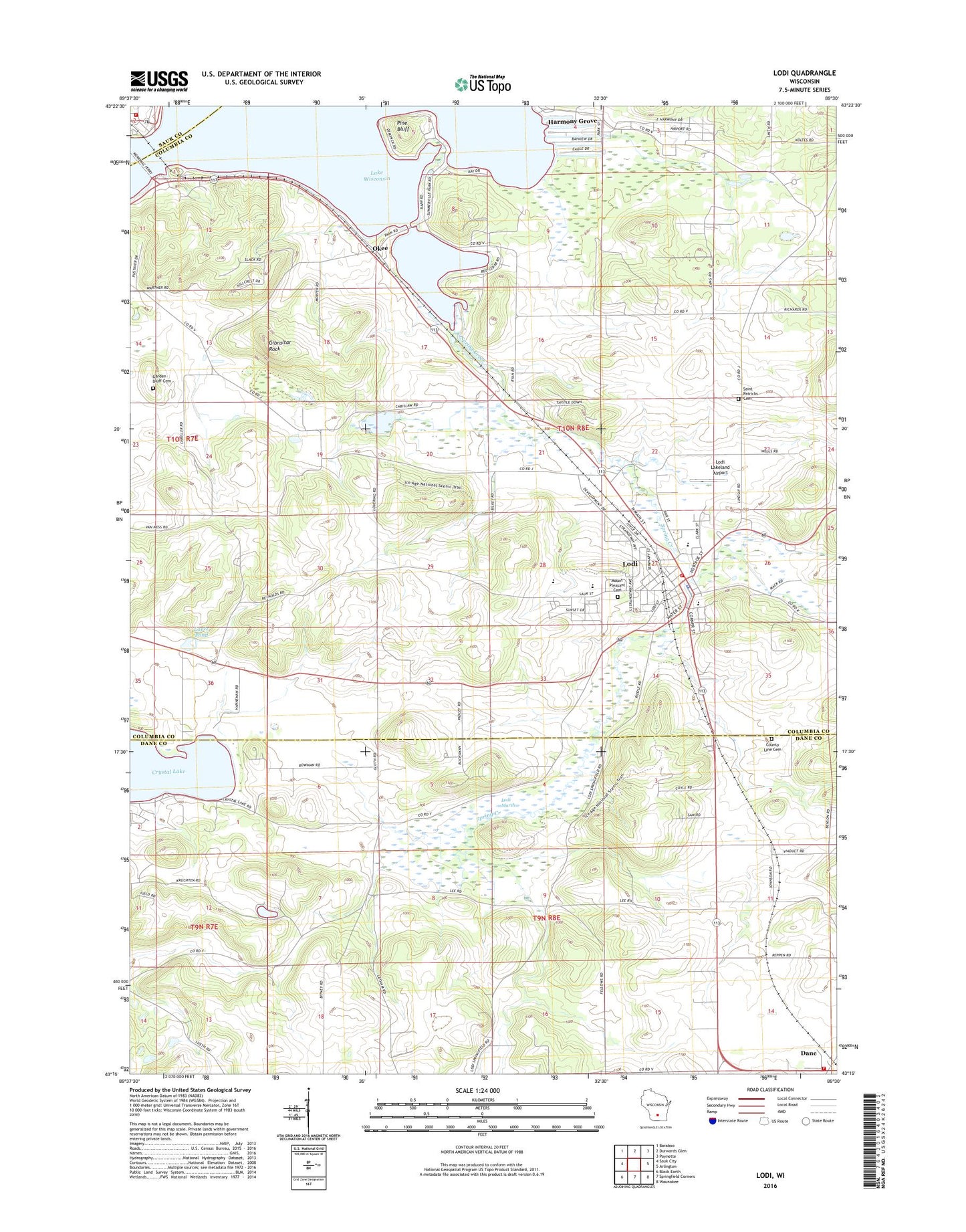
2022 topographic map quadrangle Lodi in the state of Wisconsin. Scale: 1:24000. Based on the newly updated USGS 7.5' US Topo map series, this map is in the following counties: Columbia, Dane, Sauk. The map contains contour data, water features, and other items you are used to seeing on USGS maps, but also has updated roads and other features. This is the next generation of topographic maps. Printed on high-quality waterproof paper with UV fade-resistant inks.
Quads adjacent to this one:
West: Sauk City
Northwest: Baraboo
North: Durwards Glen
Northeast: Poynette
East: Arlington
Southeast: Waunakee
South: Springfield Corners
Southwest: Black Earth
This map covers the same area as the classic USGS quad with code o43089c5.
Contains the following named places: Assembly of God Church of Lodi, City of Lodi, County Line Cemetery, Crystal Lake, Dane, Dane and Roxbury Cemetery, Dane Fire Department, Dane Police Department, Elm School, First Lutheran Church, Garden Bluff Cemetery, Garden Bluff School, Gibraltar Rock, Gibraltar Rock County Park, Gibraltar Rock State Natural Area, Harmony Grove, Lake Wisconsin, Lake Wisconsin Census Designated Place, Lakeland Hills Country Club, Lantz Pond, Lodi, Lodi Area Emergency Medical Services, Lodi Area Fire Department, Lodi Elementary School, Lodi High School, Lodi Lakeland Airport, Lodi Marsh, Lodi Marsh State Natural Area, Lodi Marsh State Wildlife Area, Lodi Middle School, Lodi Police Department, Lodi Post Office, Lodi Primary School, Merrimac, Merrimac Ferry, Merrimac Fire and Rescue, Merrimac Post Office, Mount Pleasant Cemetery, Okee, Pine Bluff, Saint Patrick's Cemetery, Saint Patricks Church, Spring Creek, Town of Dane, Town of Lodi, ZIP Code: 53555