MyTopo
Black Earth Wisconsin US Topo Map
Couldn't load pickup availability
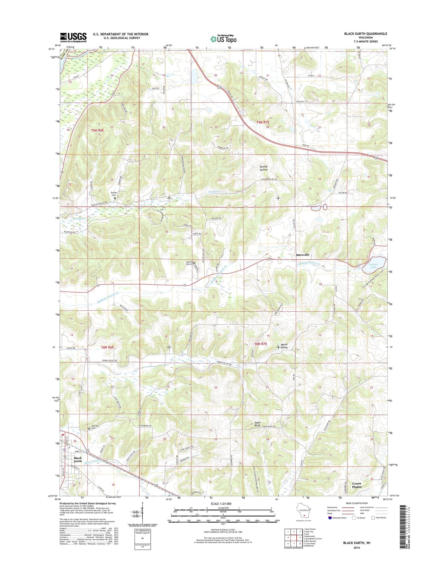
2022 topographic map quadrangle Black Earth in the state of Wisconsin. Scale: 1:24000. Based on the newly updated USGS 7.5' US Topo map series, this map is in the following counties: Dane, Sauk. The map contains contour data, water features, and other items you are used to seeing on USGS maps, but also has updated roads and other features. This is the next generation of topographic maps. Printed on high-quality waterproof paper with UV fade-resistant inks.
Quads adjacent to this one:
West: Mazomanie
Northwest: Sauk Prairie
North: Sauk City
Northeast: Lodi
East: Springfield Corners
Southeast: Middleton
South: Cross Plains
Southwest: Blue Mounds
This map covers the same area as the classic USGS quad with code o43089b6.
Contains the following named places: Aldens Corners, Black Earth, Black Earth Congregational Church, Black Earth Elementary School, Black Earth Fire Department, Black Earth Police Department, Black Earth Post Office, Dunlap Cemetery, Indian Lake, Indian Lake County Park, Marxville, Mazomanie Oak Barrens State Natural Area, Oak Hill Cemetery, Old Black Earth Cemetery, Roxbury, Roxbury Creek, Saint Johns Church, Saint John's Lutheran Church Cemetery, Saint Norbert's Cemetery, Saint Paul Cemetery, Sunning Hill Cemetery, Table Bluff, Town of Berry, Town of Roxbury, Village of Black Earth, ZIP Code: 53560