MyTopo
Steuben Wisconsin US Topo Map
Couldn't load pickup availability
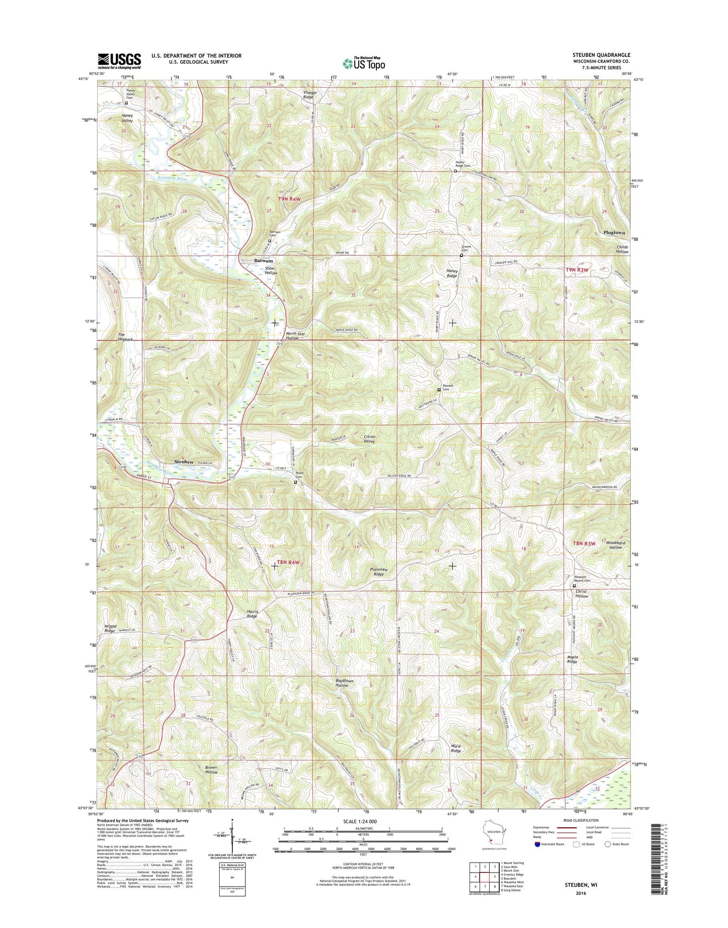
2018 topographic map quadrangle Steuben in the state of Wisconsin. Scale: 1:24000. Based on the newly updated USGS 7.5' US Topo map series, this map is in the following counties: Crawford. The map contains contour data, water features, and other items you are used to seeing on USGS maps, but also has updated roads and other features. This is the next generation of topographic maps. Printed on high-quality waterproof paper with UV fade-resistant inks.
Quads adjacent to this one:
West: Crowley Ridge
Northwest: Mount Sterling
North: Gays Mills
Northeast: Mount Zion
East: Boscobel
Southeast: Long Hollow
South: Wauzeka East
Southwest: Wauzeka West
Contains the following named places: Barnum, Barnum Cemetery, Childs Hollow, Christ School, Citron Valley School, Haney Ridge, Haney Ridge Cemetery, Haney Ridge Church, Haney Ridge School, Haney School, Haney Valley, Haney Valley Cemetery, Haney Valley School, Harris Ridge, Harris Ridge School, Hogback Prairie State Natural Area, Holliday Farm, Hulbert School, Husher Wayside Park, Maple Ridge Church, Niland Ridge School, North Star Hollow, Pioneer Wood Cook Reynolds Cemetery, Plainview Ridge, Pleasant Mound Cemetery, Posey Cemetery, Posey School, Reynolds School, Shaw Hollow, Steuben, The Hogback, Town of Haney, Town of Marietta, Village of Steuben, Ward Ridge, Wayne School, White School