MyTopo
Crowley Ridge Wisconsin US Topo Map
Couldn't load pickup availability
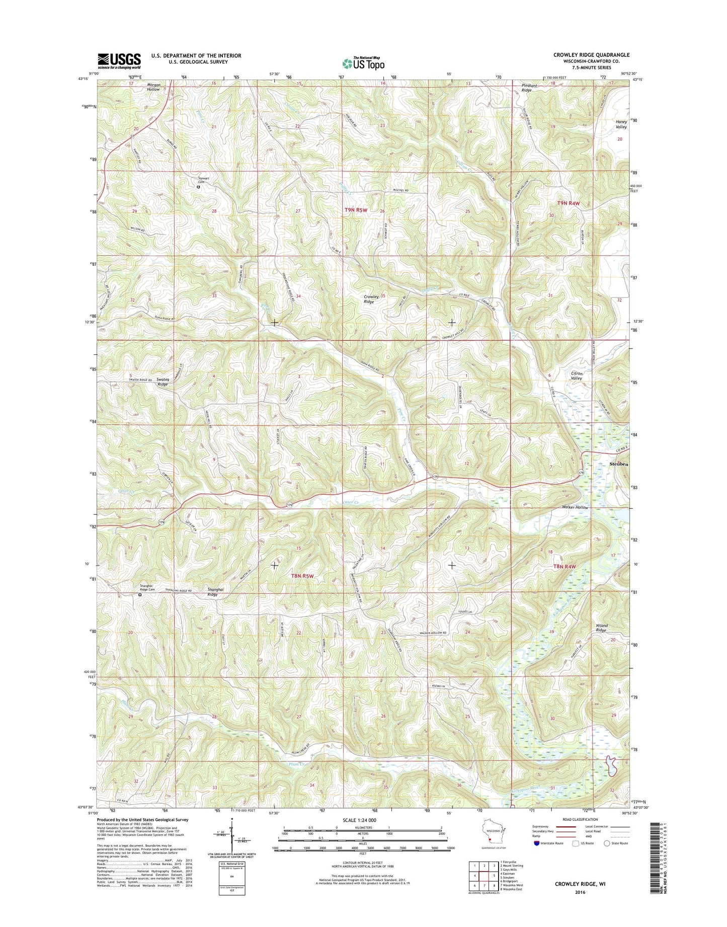
2022 topographic map quadrangle Crowley Ridge in the state of Wisconsin. Scale: 1:24000. Based on the newly updated USGS 7.5' US Topo map series, this map is in the following counties: Crawford. The map contains contour data, water features, and other items you are used to seeing on USGS maps, but also has updated roads and other features. This is the next generation of topographic maps. Printed on high-quality waterproof paper with UV fade-resistant inks.
Quads adjacent to this one:
West: Eastman
Northwest: Ferryville
North: Mount Sterling
Northeast: Gays Mills
East: Steuben
Southeast: Wauzeka East
South: Wauzeka West
Southwest: Bridgeport
This map covers the same area as the classic USGS quad with code o43090b8.
Contains the following named places: Burton School, Citron Creek, Citron Valley, Crawford County, Crawford County Infirmary, Crowley Ridge, Dean School, Duffy Creek, Dunne School, Grandow School, Niland Ridge, Otter Creek, Pine Creek, Pleasant Ridge, Pleasant Ridge School, Progressvie Ridge School, Shanghai Ridge, Shanghai Ridge Cemetery, Stuart Cemetery, Swatek Ridge, Swatek School, Town of Eastman, Valley View School, Walker Hollow, ZIP Code: 54657